This guide was written by Obbie Todd, a local naturalist, who shares folklore, pieces of Daviess County history gathered from research and stories from land owners, and interesting facts about the native plants, trees, and land you will encounter along the trail.
East to West Greenbelt Trail – Starts at Yewell Heritage Park
While using the Greenbelt Trail Guild, you will embark upon a journey of time, covering over two centuries of history, culture and folklore. Meandering along the ten-foot wide path, you will identify trees, wild flowers, and various plant and animal species.
The red pavement to your right is a tributary of the Greenbelt built and maintained by Daviess County Parks, which leads to Horse Fork Creek Park home of Daviess County Youth Soccer and various neighborhoods (Brookhill, The Brooks, Lake Forest and Woodlands) on the eastern side of Owensboro.
The first steps through Yewell Heritage Park head west towards the underpass. There is a 7.5 acre lake to your left and a solitary Sycamore to your right. The lake was built for the neighborhood of Brookhill, not for the six pound bass that have been hauled out, rather for the dirt to raise the land above flood stage.

Virginia Creeper
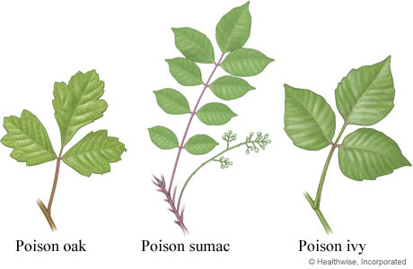 Try to stay on the trail at all times. You will want a safe trip and beware of Poison Ivy along the Greenbelt. Remember leaves of three let it be! Poison Oak or Poison Sumac are rare in this area. What people believe is poison oak, is actually Virginia creeper, a five leaf plant that does no harm.
It’s noisy and scary at times under the bridge. How much weight is above you? Taking into consideration one cubic yard of concrete weighs 2 tons: each column on your left weighs 30 tons. The cap, which is supported by the three columns, weighs 50 tons. On the road above there, is another 500 tons of concrete and 75 tons of steel. Total weight is 1,710,000 pounds or 855 tons.
From May until August, Barn Swallow can be seen living in mud nest under the bridge. These birds migrate from South America and some from as far away as Argentina. Can you believe Swallows can fly up to 600 miles a day in search of food?
Walking out from under the expressway look left at the vegetation. The fern like plant is called Crown Vetch, planted by the highway department. Birds planted the blackberry bushes and honeysuckle.
At the park bench and sign is Yewell Heritage Park, a 44-acre park donated by Roy and Beverly Yewell. The Yewell Heritage Park includes the parking lot, lake, and 12 acres on the East side of the bypass, and 32 acres on the West side of the bypass. It is hard to believe the Yewell family once owned 17,000 acres outlining Horse Fork Creek.
The first Yewell, Jeremiah, came from Virginia in 1786. He first settled in Oldham County and became one of the first whiskey makers of Kentucky. Moving to Daviess County in 1840, he arrived by flatboat as slaves drove livestock overland. The Yewells built a house in the Brookhill area and today it’s recorded as the oldest brick house in Daviess County. It was a true Virginia Plantation. Slaves built a fire on the hearthstone every day, even in summer.
A 7th generation Yewell, Roy III, is a master storyteller of the Yewell history. He remembered family tales of Indians living in this area and how settlers gave cattle to the Indians as a peace offering. Other stories were of bears that killed farmer’s livestock and of buffalo that carved trails as wide as six lane highways. In the fall of 1833: John Hazelrigg of the Masonville Precinct killed the last bear in this area.
Unfortunately, slavery was a common practice in the 1800’s and Jeremiah Yewell owned 50 slaves when he settled in Daviess County. We also know when the Wendell Ford/ US 60 Bypass was being constructed, tons of clay tiles were dug up that had been laid by slaves to help drain the Horse Fork Creek bottomland. Landsdowne Subdivision is built on the former Yewell’s family slave cemetery.
During the early 1800’s, the McFarland family owned property that joined the Yewell Estate. John McFarland married the first child born in Owensboro and went on to have 18 children. He was said to have made the first Whiskey and Brandy in the area. He also lost 130 acres of tobacco and $40,000 worth of slaves because of the Civil War.
After the Civil War, slaves took the last names of their masters, and the Reverend R.L. McFarland, Sr. a distinguished ordained minister and community leader in Owensboro was a descendent of the McFarland slaves. R.L McFarland, Sr. is one of the great testimonies in the rich history of Daviess County. Born in 1917, he became the first black political leader in Daviess County. He held a city commissioner position for 11 years. Preaching the gospel at Mount Calvary Baptist since 1956, Reverend McFarland proved one man can makes the difference in changing so many lives. He preached until the age of 87. He died September 13, 2002.
In the months of April and May, these fields are full of yellow wildflowers called Butter Weed. In the summer months, you will see Queen Anne’s lace and a yellow fern like wildflower called Partridge Pea. Partridge Pea is the host plant for the Sulfur Butterfly. Meaning; the small yellow Butterfly lays its eggs only on the Partridge Pea plant. If the plant didn’t exist, the butterfly wouldn’t exist.
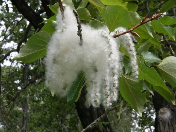
Cottonwood
At the bend, a ditch runs under the trail. Look left at the Cottonwood Tree. Its heart shaped leaves accented with its light gray deeply furrowed bark, characterizes the tree. Found throughout Horse Fork Creek landscape, it can grow as high as 100 feet. These trees love water and that is why they are found around creek and river banks. Have you ever walked in the spring and noticed a white cottony substance floating in the streets of Owensboro? That is the seed of the Cottonwood tree.
A black fence leads to the neighborhood of Heartland Subdivision. Bill Jagoe Sr. donated this land as well as land on Byers Avenue for the development of this section of the Greenbelt. This tributary was one of the first in connecting neighborhoods to the Greenbelt. People living close to the Greenbelt can ride bikes and get almost anywhere in Owensboro within 30 minutes.
The plaque to the left honors Sue Fowler. Sue was the administrator for the City, overseeing the development of the Greenbelt. In a 12 year project to build a 15 mile long multi use trail system, Sue helped design the trails, prepared and administered grant funds, worked on the Greenbelt advisory Board, secured match of land and cash donations, design the signage and informational brochure and connected on-street bike lanes throughout the City, to the Greenbelt. One person who made the difference in so many lives, thank you Sue!
Trek 100 yards to the next bench and notice a gap in the trees to your right. This is where a man-made curve altered the course of the Horse Fork Creek rather than natural erosion, to accommodate the location of a new railroad. To help you understand this, just imagine this; from 1887 until 1984, trains ran on the other side of Horse Fork Creek. R.S. Triplett and Colonel MV Monarch, both wealthy residents of Owensboro started a train line that ran from Owensboro to Fordsville. Then the Illinois Central bought it in the 1890’s and opened it up to Horse Branch and the Falls of the Rough. It was the last of the passenger trains running through Owensboro until it closed in 1984.
Interesting fact; in 1866, Owensboro voted in its first mayor and his salary was $100.00 a year. His name was E.S. Ayers, but never resided over the deliberation of the council, dying a week later.
Next, you will see a bench and a park information sign. This is the most serene part of the Greenbelt trail, with only the whistling of the wind and singing of birds. In the winter, you could witness hundreds of Canada Geese feeding in the area.
You are still in Yewell country. Walking from here until you step foot under Highway 231, was made possible by land donated by Jim Yewell, Betty Yewell-Yeiser and their mother Sarah Yewell Hagerman. Betty and Jim are also direct descendants of Jeremiah who arrived in Daviess County in 1840.
At the 308 mile marker, until arriving at Old Hartford Road, you will discover trees found everywhere in Kentucky and the Southeast United States. The Greenbelt isn’t just a great place to exercise – it is an outdoor classroom for learning about the wonders of nature. Nature has inspired people to do great things, including poetry.
I think that I shall never see
A poem lovely as a tree
A tree whose hungry mouth is prest
Against the sweet earth’s flowing breast;
A tree that looks at God all day,
And lifts her leafy arms to pray;
A tree that may in summer wear
A nest of robins in her hair;
Upon whose bosom snow has lain;
Who intimately lives with rain,
Poems are made by fools like me,
But only God can make a tree.
Joyce Kilmer, Author

Sassafras
The Sassafras will have three different types of leaves, one leaf with one thumb, one with two thumbs and one with three. But what you’ll notice more than anything on the Sassafras is the branches. They are great for roasting marshmallows or hot dogs. Just look up in a tree and if you can tear off a branch and stick four or five marshmallows on it, then it’s a Sassafras. If you find a small tree and pull it up, the roots smell just like Root beer, which is where the original drink originated. The tree becomes dark red in fall.
In 2019, a new disease, Laurel Wilt, has been detected in southwestern KY with the potential to rapidly sill sassafras trees. Laurel wilt is a fungal disease caused by the invasive pathogen Raffaelea lauricola. It is transmitted by the wood-boring redbay ambrosia beetle. In Kentucky, sassafras is likely to be the species most affected by laurel wilt although the fungus can also cause disease on spicebush. Be on the lookout for sassafras trees that have died suddenly, have dead red-brown leaves still attached, and have dark streaky staining in wood just under their bark. Learn more: forestry.ca.uky.edu/laurel-wilt
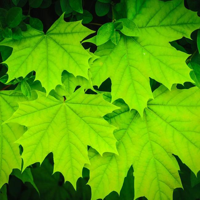
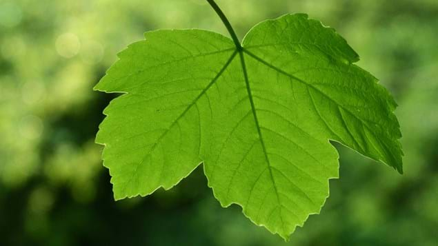
Sugar Maple
The Sugar Maple has gray bark and a leaf with 5 lobes; in contrast to the red maple which is smaller and has only 3 lobes. It will look just like the picture on the Canadian flag! Each year one tree produces 5 to 60 gallons of sap per year depending on the size of a tree. It takes about 32 gallons of sap to make one gallon of Maple Syrup. Leaves becomes Yellow/Red in fall.
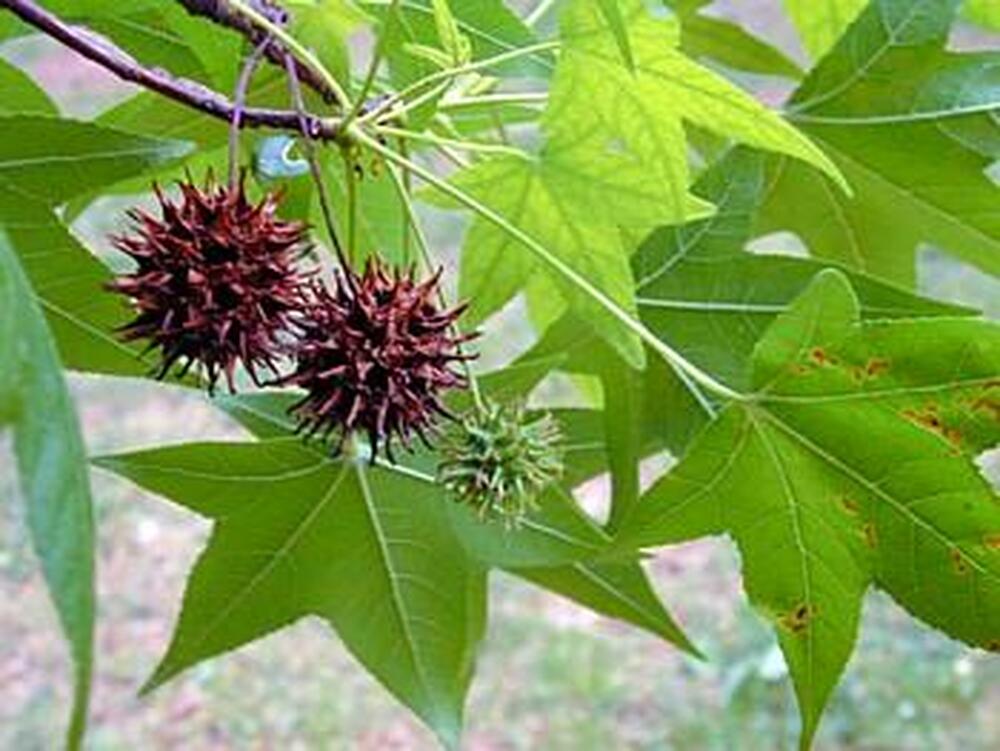
Sweet Gum
Across the ditch, you see the Sweet Gum. It is that tree that produces those darn woody balls that everyone hates mowing over. The leaf looks exactly like a star. This tree was our first toothbrush, shaving down the bark to pick teeth after meals. Because of its gummy residue, one could pick his/her teeth without getting the wood stuck in-between the teeth. The leaves becomes Red to Purple in fall.
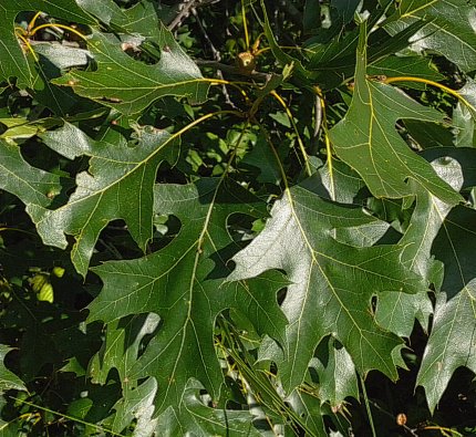
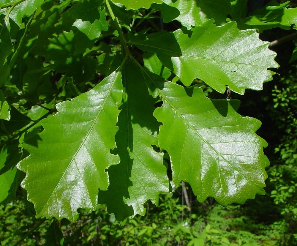
Black Oak
The Black Oak is the next tree on the Greenbelt and is characterized by a dark leaf with a whitish back. Like all oaks, it will produce acorns. The Black Oak is in the Red Oak family and red oaks often become host of the woody horned gall wasp. This wasp lays its eggs only on red oaks, producing the woody balls found on the branches.
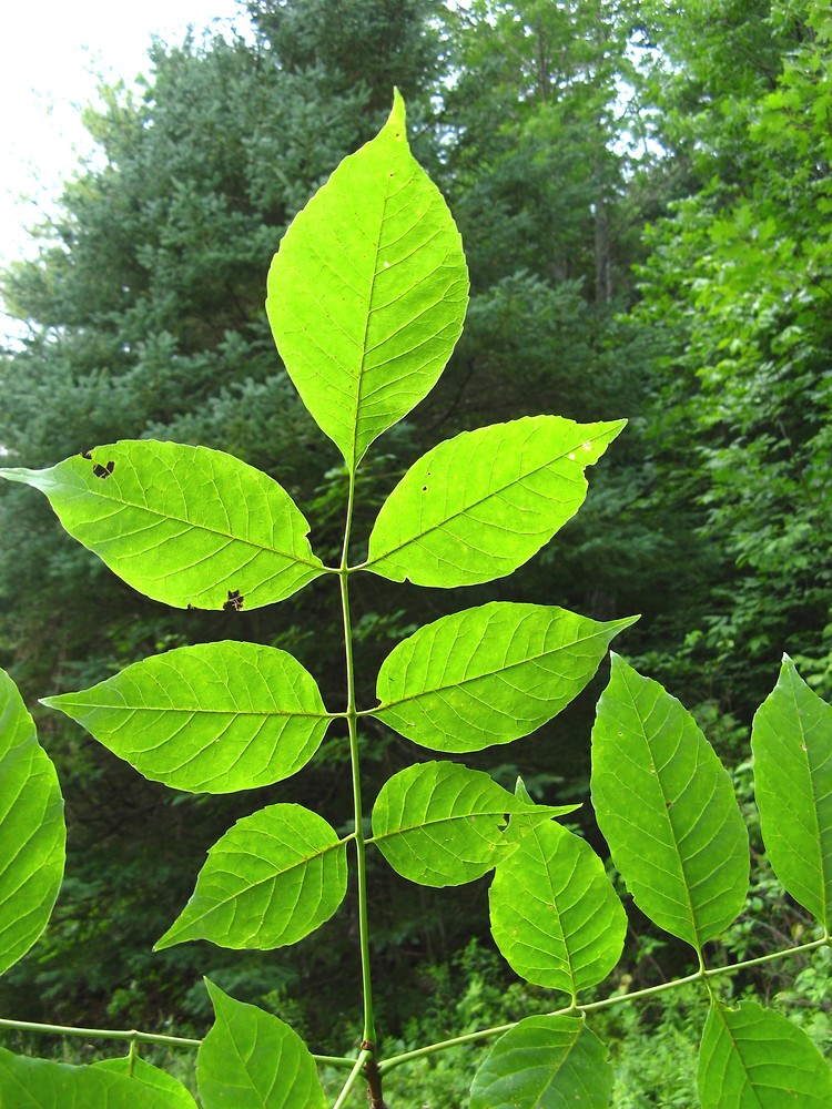
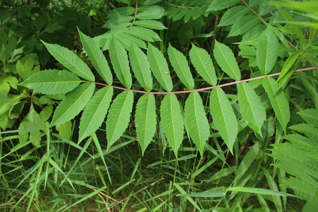
White Ash
The wood for baseball bats and bowling lanes come from this next tree. It is the White Ash. Notice the 7 leaflets on each leaf. That is how you can tell it is an Ash. We have many types of Ash in Kentucky but they all have 7 leaves. The Ash is in the Maple family.
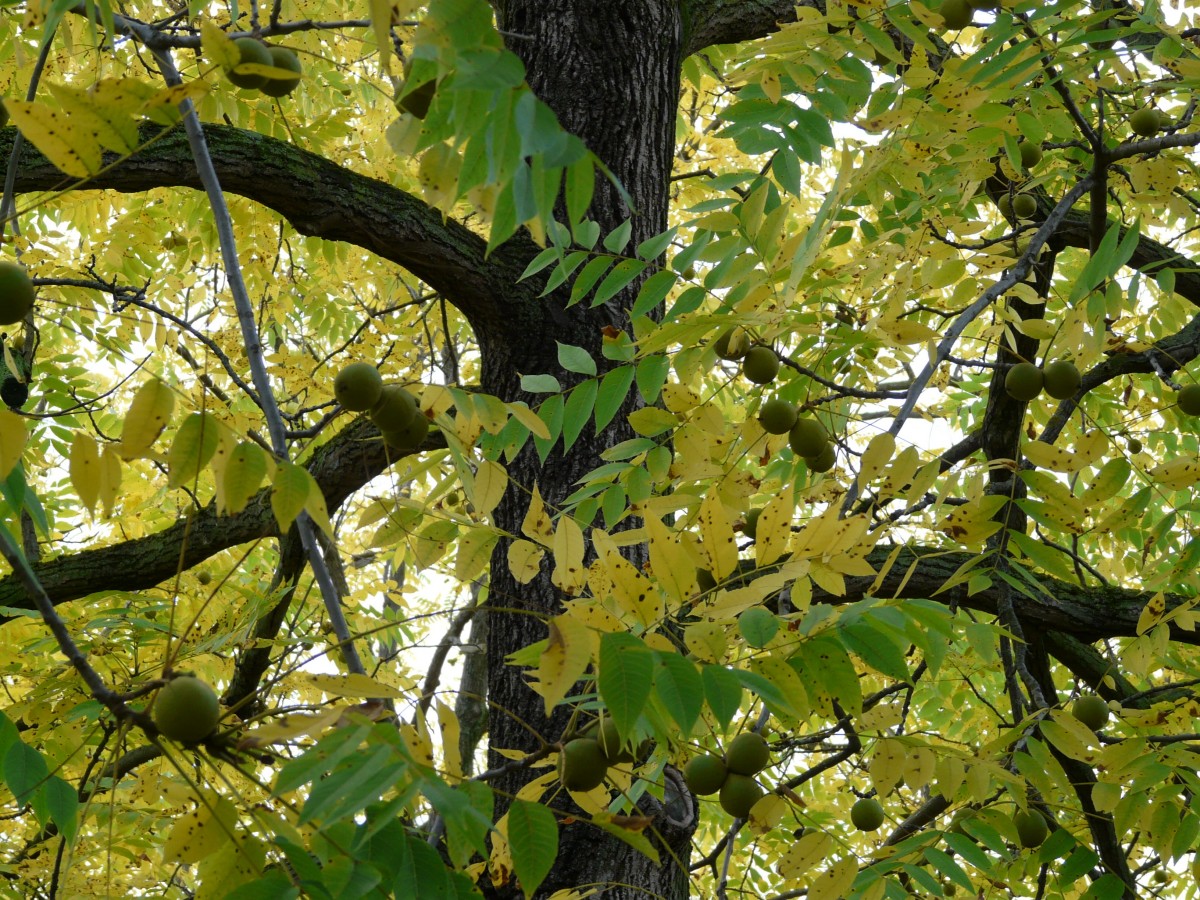
Walnut Tree
The trail slightly bends and the next tree along the Horse Fork Trail is the Walnut. This majestic tree can grow as high as 100 feet tall and 3 feet in diameter. Seeing a Walnut tree this size is a rare sight because they are often cut down and used for building cabinets and furniture. The leaves are lighter than most nut trees (Pecan is army Green) and the green encased fruit can be found hanging in the fall after the leaves have fallen.
Sycamore
The last tree to identify before arriving at Old Hartford Road is the Sycamore. This tree with its tri-colored bark is best known from the writing of Mark Twain. As he traveled down the mighty Mississippi, he witnessed families living in the enormous trees naturally hollowed out after reaching 200 years old. The Sycamore is easily identified from a distance by its white bark.
Remember, the trees and wildflowers you have discovered today will be here tomorrow, next season and 100 years from now. Nature doesn’t change!
This area was especially active during and after the Civil War. Many citizens of Daviess County were members of the Whig party which more of less became the Republican Party. Abraham Lincoln became our first Republican President. He was born in Kentucky and always considered himself a Whig. The Whig party was started by Kentucky’s Henry Clay. The other half of Owensboro considered themselves Democrats, siding with Jefferson Davis who was also born in Kentucky and leader of the Confederacy. The democrats believed in everything the southern heritage represented, including slavery. Daviess County became divided, friends fought against friends, family against family.
Here are some historical facts about this area. Elmwood Cemetery just a mile down the road started in 1856. Our city bought 9 acres to bury our citizens, who up to that point had been buried downtown next to the court house by the Masonic Building. In 1868, we increased the cemetery by adding 40 additional acres 1 mile southeast of Hartford Road. The name changed from Rural Cemetery to Elmwood. “Nearly” all the people in the old cemetery on 4th Street were moved to Elmwood. Today you can attend the “Voices of Elmwood” a hayride through Elmwood Cemetery learning about the residence who reside there and the history of Owensboro.
The Daviess County Fairgrounds was once located in this area, using Old Hartford Road as the entrance. The first County Fair was in 1850 and was more or less successful until the beginning of the Civil War (1861-1865). Then in 1866 after the Civil War, the City bought 25 extra acres by the Rural Cemetery to renew the tradition. In 1866, the weeklong event brought in 6000 people, uniting friends and family who had not seen each other since the war. It included livestock judging, horses, quilts, agriculture products and needle work.
The highlight of the event was the Lady Equestrian competition. The winner got an elegant $50.00 saddle. Patricia Pendley Strother won the first competition but not without dissent of the decision of the judges. Many wives in attendance believed she only won because she showed too much leg.
When year did the Civil War begin? April 12, 1861
To the right is the old General Electric (GE) plant formerly known as Kentucky Radio Company (Ken-Rad). It was a huge part of our City’s history, especially after World War II. Many veterans from all over the country came into Owensboro and started families after getting a job at the GE plant. At one time, it employed 6,600. The first professional baseball game played at night, was lit by the bulbs made at this plant. (1935 Reds vs Phillies at Cincinnati’s Crosley Field)
Be very careful while crossing Old Hartford Road. This is a busy road with a lot of history. Hartford Road was mentioned twice being used by the Southern Confederacy when entering Owensboro. It wasn’t called “Old Hartford Road” until 1957 when Highway 231 was finished. This road was the main north-south thoroughfare in the eastern part of the county. A map dated 1876 shows it winding to the county line at Pleasant Ridge. Historical records show that in 1882 the Daviess County Road Company was empowered by Legislation to erect gates and begin collecting a toll every five miles along roads leading into Owensboro. These gates were usually built at someone’s house living on the road.
This went on throughout Kentucky until disgruntled patrons torched a couple of tollhouses and the legislators abolished the law. With road improvements, stagecoaches could then travel at a grand speed of eight miles per hour.
The toll prices were: Horse or mule with one rider…2 cents, Stage Coach with six riders…35 cents, Stage Coach with nine riders…55 cents.
Crossing Old Hartford Road, you will see a green water fountain and have the chance to identify more wildflowers. In the early summer months, you can view purple Hairy Vetch, red Clover, and yellow Hops Clover. While in the fall, yellow Wing Stem, purple Iron Weed, and blue Chicory fill the open spaces. When learning about nature, don’t get in a hurry. Technology will constantly change but the names of trees, flowers and birds will stay the same throughout our lifetime. So walk slowly, walk often and learn something new each time you visit the Greenbelt.
Bluebird boxes are found although the Greenbelt. With the European Starling overpopulation, the Eastern Bluebird almost became extinct. Bluebird boxes brought the numbers back and the species is now going strong. 100 European Starlings were introduced in New York City’s, Central Park, in the early 1890’s. Today there are billions of European Starlings in the US.
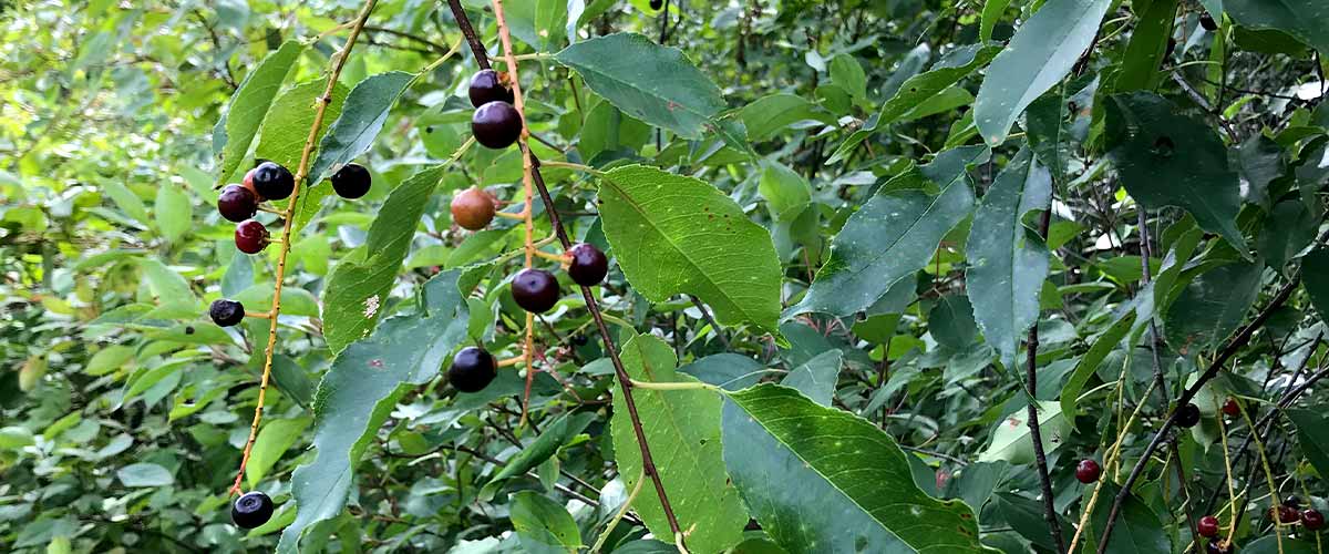
Black Cherry Tree
As the trail begins to straighten out, look towards the Horse Fork Creek and identify the Black Cherry Tree. It’s very noticeable with its shiny green leaves and reddish bark. Younger trees will show horizontal lines in the bark but as it gets older it will lose the lines and develop a scaly exterior. The berries turn dark red in July. The tree itself is responsible for the death of 525 thoroughbred foals since 2001. The Eastern Caterpillar eats the cherry leaves that contain cyanide toxins and the horses graze on the grass that contains the poisonous caterpillars. The breeding of thoroughbreds in Kentucky is the second leading Kentucky industry with $676 million in sales in 1999. Needless to say, there are no more Cherry Trees found in or around horse farms.
There is a pond to the left. All ponds have their own ecosystems. The word ecosystem sounds complex but it is quite simple. Look at the pond and realize the sun makes the algae grow. (Stage 1) The bugs and flying insects eat the algae. (Stage 2) The fish and frogs eat the insects. (Stage 3) The Heron, Muskrat, and Snakes eat the fish and frogs. (Stage 4) And the leftover waste is deposited back into the pond to become algae again. (Stage 5)
Great Blue Herons and Muskrats can be found working the lakes and creek. They are looking for crawfish and small fish. While high in the trees, woodpecker, such as the Yellow Flicker and the Downy Woodpecker find insects. Did you know Kentucky is a major flyway for birds migrating from South America? Did you know that birds that eat only insects have to return to Mexico and South America when it starts getting cold? This is true except for the Woodpeckers and a few other species. They forage on wood to find dead insects. This is why putting out suet (beef fat) is so attractive to birds in the winter.
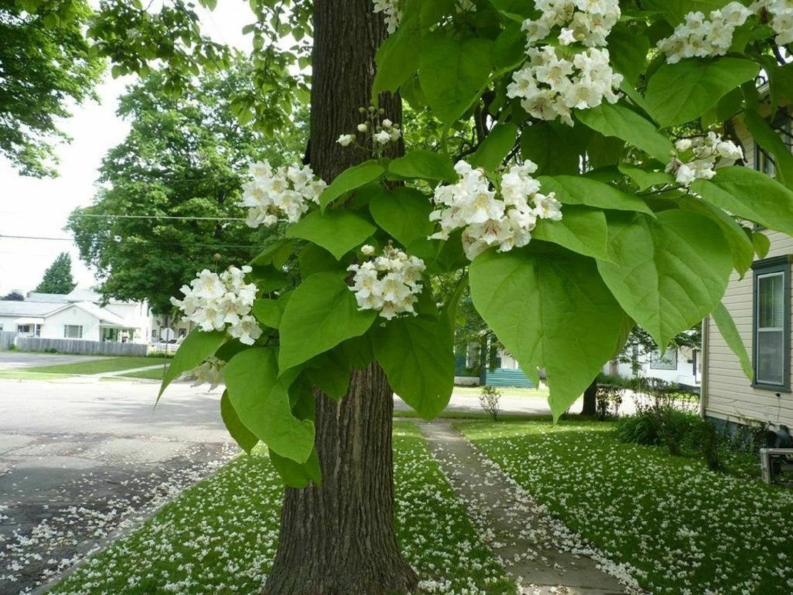
Catalpa Tree
In front of the pond is the Catalpa Tree. Notice the leaves in the summer look like the leaves of a tobacco plant. In winter when the leaves are gone, you will notice long bean pods hanging off the trees limbs. You will see this tree again in the south section of the Greenbelt.
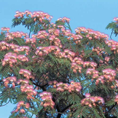
Mimosa Tree
A small Mimosa tree strangely grows out into the trail. This tree is almost tropical, coming from Iran. Similar to a sensitive plant which folds up when touched, the Mimosa folds up at night. The sweet scented pink blooms of the Mimosa last most of the summer and is loved by Hummingbirds.
At the bench, you can see highway 231. Look above you and identify the White Mulberry. The White Mulberry came to us by way of China. In the 1800’s we had to import silk. The United States decided to produce its own silk by raising Silk Worms and not depending on China. So what does a Silk Worm eat? White Mulberry leaves. Did you know that one fiber in one cocoon can be long as 3000 feet? Notice the bark has an orange tint.
Smooth Sumac
The trail bends and Smooth Sumac is lining the trail. The only shrub native to all 48 contiguous states, it is also the first species to become blood red in the fall. The sour red fruit that is mostly seed, can be chewed to quench thirst or prepared in a drink similar to lemonade. We do not have Poison Sumac or Poison Oak in Kentucky.
Before going under the bridge, look right and realize that less than a mile away, was a Civil War camp for the Union Army 15th Calvary. Daviess County had only one major battle during the Civil War and that was the Battle of Panther Creek. The commander of the 15th Calvary was killed during the battle.
The land where Gabes Tower was built was once a professional baseball field from 1930-1950 for the professional baseball team called the Owensboro Oilers. Hall of Fame player Tony Kubeck, the American League Rookie of the year played there. Owensboro has always been known for great baseball. In Sydney, Australia Olympics, the United States defeated the Cubans to win the gold medal. The center fielder was none other than Owensboro’s Brad Wilkerson.
The Greenbelt runs under Highway 231. This road was formerly named Highway 71 and was not paved until 1932. The Owensboro Messenger Inquirer said, “It was paved in order to provide a dust free road between Owensboro and Hartford.” The Highway number changed in 1957.
You may notice animal tracks under the bridge. The engineer who designed the Greenbelt was stumped how to cross the highway, but it wasn’t until engineer Jim Riney saw a 20 pound Raccoon walk under the bridge that he decided people could cross under it too. The first settlers of Owensboro followed a Buffalo trace in getting here. We also know the Yewell and Mason families arrived in Kentucky, by way of Virginia by following the Cumberland Gap. The Cumberland Gap was actually cut by Indians who followed animal tracks and Daniel Boone was the one who widen it, giving people the opportunity to cross over with wagons.
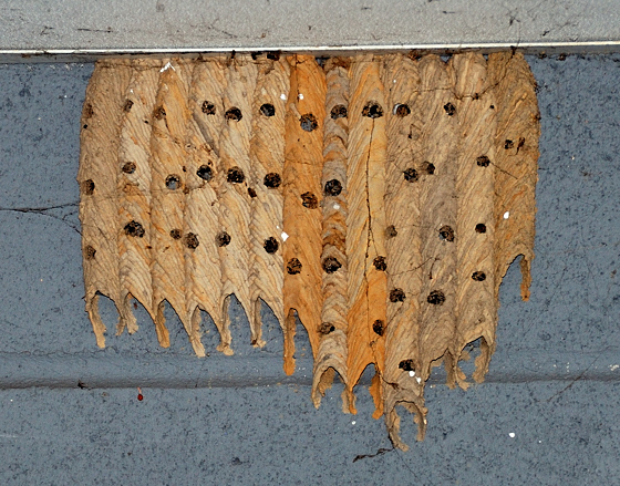
Mud Dauber Nest
Under the bridge, you will see wasp nest made by Mud Daubers. The black and yellow Mud Dauber builds the nest and the blue Mud Dauber rather than building its own nest, just takes over the yellow dauber’s nest. Inside each organ-like nest is paralyzed spiders that the Mud Dauber stores for its young to eat when they hatch. The Black Widow Spider is one of its favorite. These wasp are non-aggressive and rarely sting unless touched or caught in clothing.
Coming out from under Highway 231, Dairy Queen is on your left. Built in December 7, 1972, Dairy Queen sells 30 million gallons of ice cream nationally each year. Bathrooms are inside.
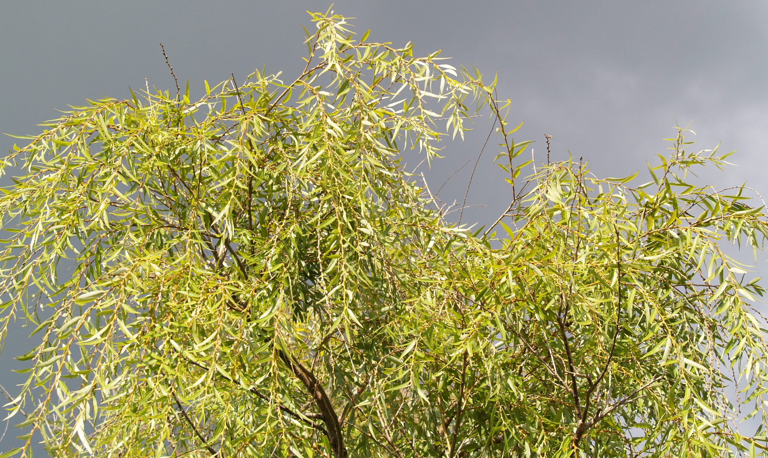
Black Willow
The only tree in this section is by the white fence. It’s called the Black Willow or Swamp Willow. It was used during the Civil War as a source of gun powder and has the same chemical found in aspirin.
Ralph Waldo Emerson once said, “Everything in nature contains all the power of nature.” Because of the velocity of water in the Horse Fork Creek during a rain, a slight curvature in the creek causes the water to swirl to one side of the embankment and erode not only the bank but also a portion of the original Greenbelt walking trail. The amount of water in the creek on an average day would not seem significant enough to tear away the creek bank, although the impact of the water multiplies by 1,000 when Owensboro gets a two inch rain. The City had to create this rock embankment to stop erosion. There is 450 tons of rock making up the 100 foot rock embankment. The basket like structure holding the rock is called a gabion.
You will notice a stretch along the creek with dead or very little vegetation. This is because Owensboro Municipal Utilities (OMU) kills the vegetation every five years or so to keep tree limbs out of the power lines.
Walking between the power line poles, notice the height of each pole. If the poles is over 55 feet tall, it is a Douglas fir. If it is less than 55 feet tall, it is a Southern Yellow Pine. All utility poles are pressurized and treated in Alabama with a chemical called Penta.
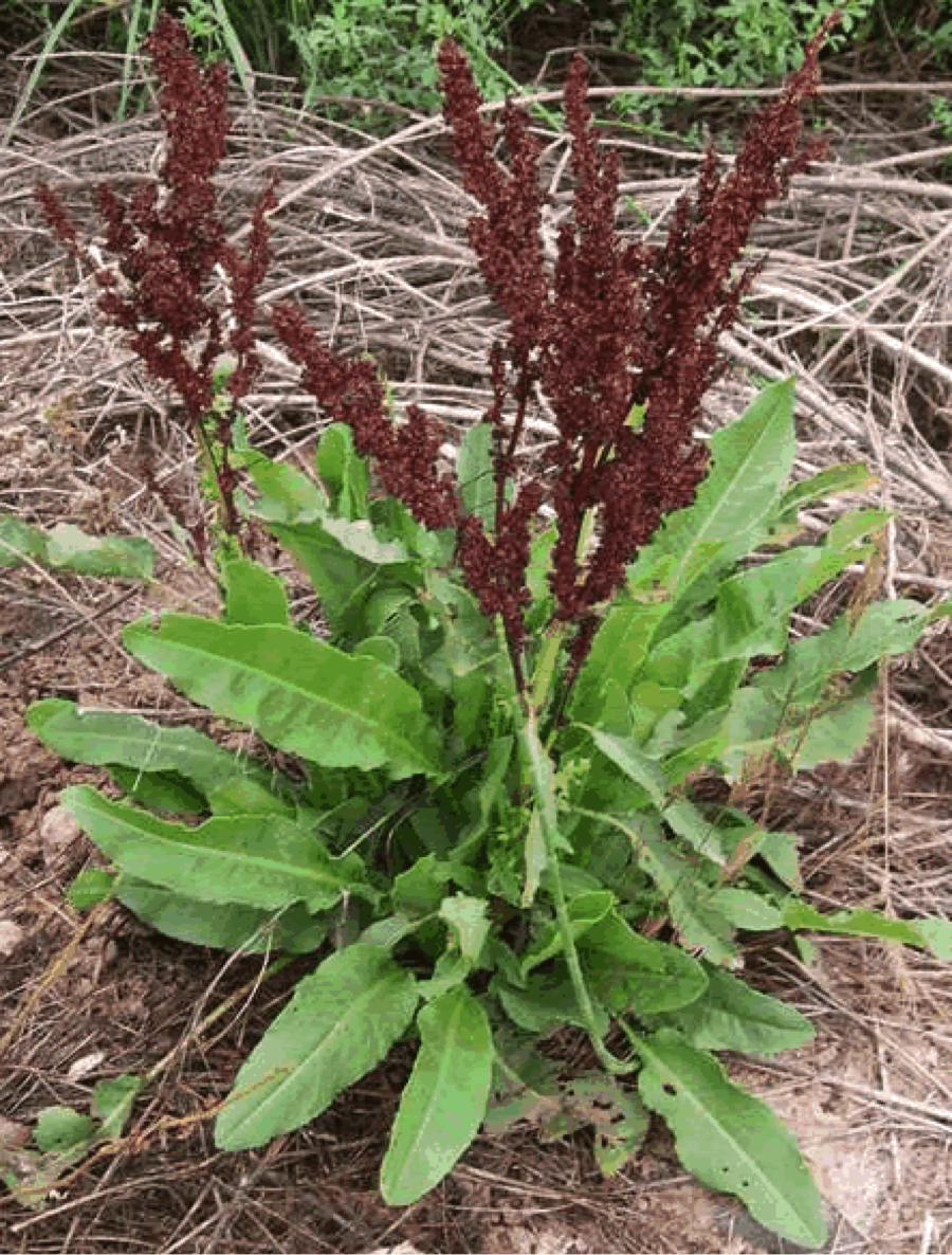
Curley Dock
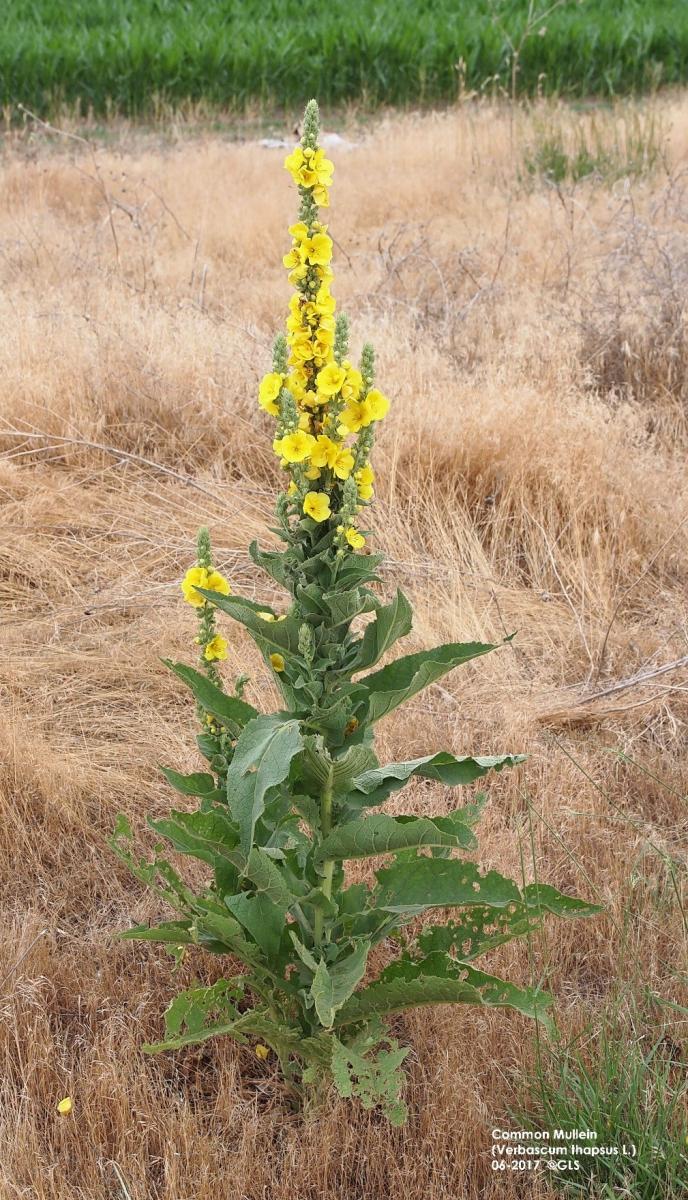
Common Mullein
On your way to Byers Avenue, you will be passing high grass and weeds to your right. In those weeds you can identify Curly Dock and Common Mullein. The plants are really not that noticeable, looking much like the weeds they grow around. Curly Dock has no bloom except for a seed head on top of a large lanced shaped leaf. By no means is it pretty, although herbalists consider the dried tea root good for chronic skin disease, rheumatism and sore throats. Common Mullein has a large, thick greenish-gray fuzzy leaf. It can be a tall plant, usually with a single stem terminated with a spike of yellow flowers. The leaf is used to stop a hacking cough. Boil a Mullein leaf in a pot and as the steam rises, the recipient holds a towel over his head catching the steam.
Interesting fact; How old is Owensboro? The first permanent settlement in what is now Daviess County was probably made in 1797 or 1798, by the celebrated William Smither, more popularly known as “Bill Smothers”; this settlement was made on the site of the present day City of Owensboro. Daviess County was once a portion of Ohio County. Owensboro became a chartered city of Kentucky the same year Mississippi became a state (1817). Owensboro was established before the creation of 31 other states.
After the mile marker 304, stop at the next set of poles and look at the stop sign. Based on your distance and the size of the sign, if you can read the stop sign clearly, you have 20-20 vision. This is based on the fact that 20-20 vision is based on reading something clearly which is 20 feet away.
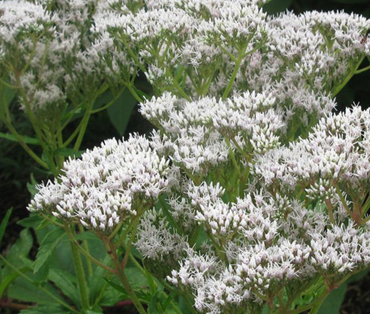
Eupatoria
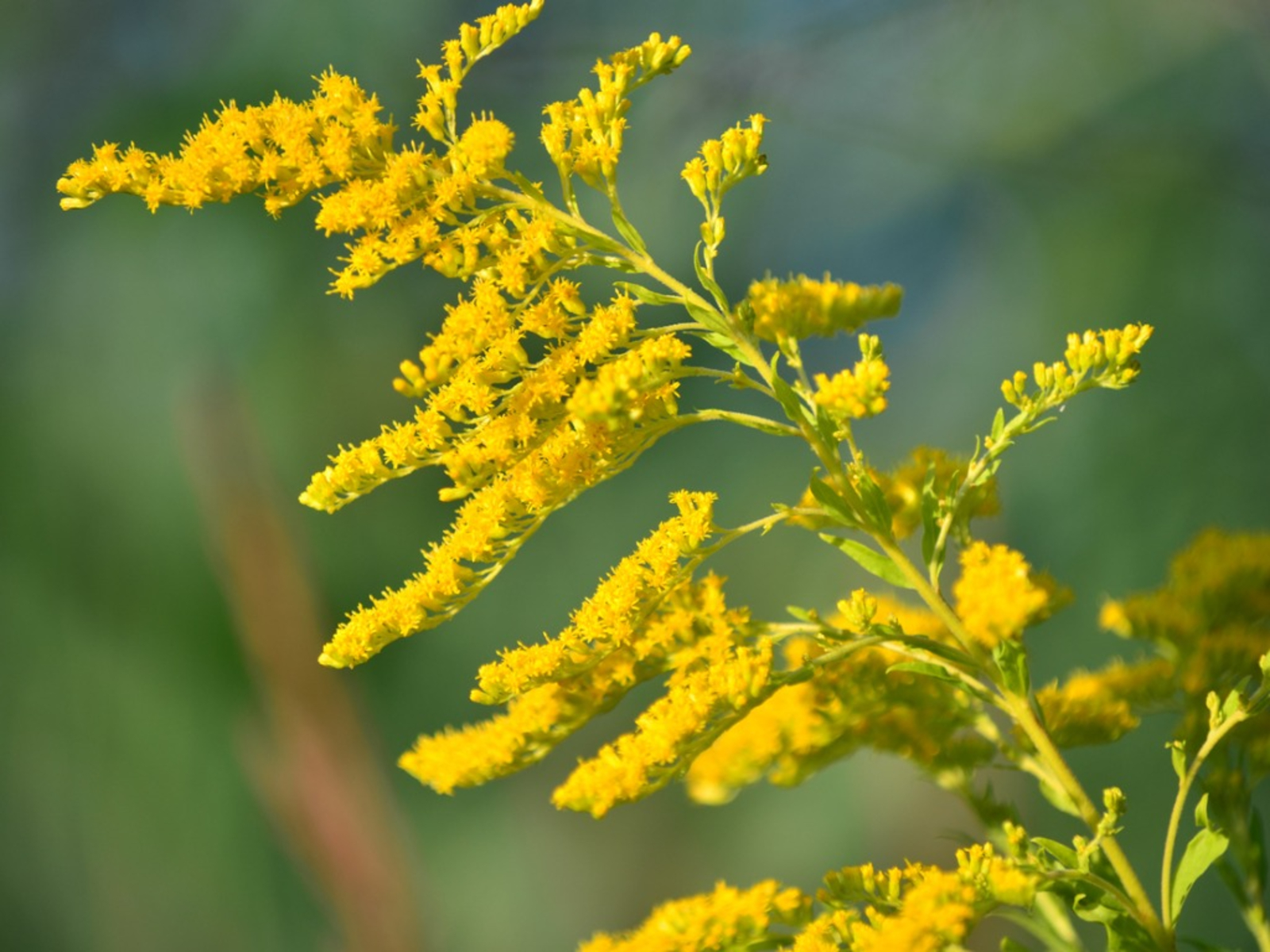
Goldenrod
After crossing Byers Avenue and before arriving at the bridge, see if you can identify some wildflowers. In the fall, tall looking sunflowers are called Jerusalem artichoke. The white flowers are called Eupatorium. But if you remember only one, remember our state flower, Goldenrod.
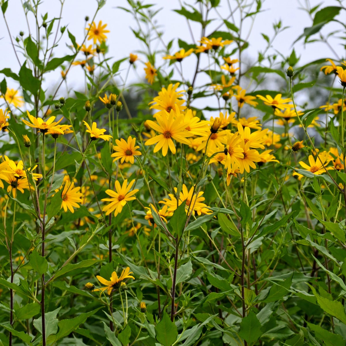
Jerusalem Artichoke
Back in 1868, while standing on a bridge crossing Horse Fork Creek, a young boy in the Yewell family was fishing. Two men riding mules, looking ornery and scruffy stopped before crossing the creek to ask the boy for directions. They were looking for Hartford Road to get out of town. They called themselves the James brothers. Three weeks later, Frank and Jesse James robbed the Russellville Bank in Russellville, Kentucky.

Belted Kingfisher
Crossing the bridge, look towards the pond. You may see the Belted Kingfisher. Looking similar to a Blue Jay, but twice the size, it makes a distinguishing clicking sound while flying.
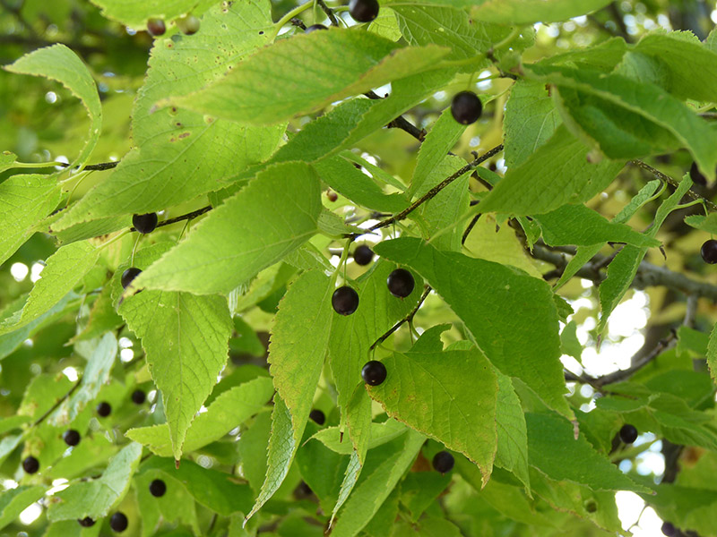
Hackberry Tree
The first tree is on your left is a Hackberry. This tree is easily identified by its gray, warty bark. Many birds including Quail, Woodpeckers, Robins and Cedar Waxwings consume the sweet berries.
White Oak
The trail swings and then straightens out, coming upon the magnificent Swamp Chestnut Oak on your right. This oak is in the White Oak family and does not have bristles on the edge of its leaves. The bark has a white tint while the leaves are broad and looks similar to the leaf of a Chestnut tree. This tree is believed to be 250 years old.
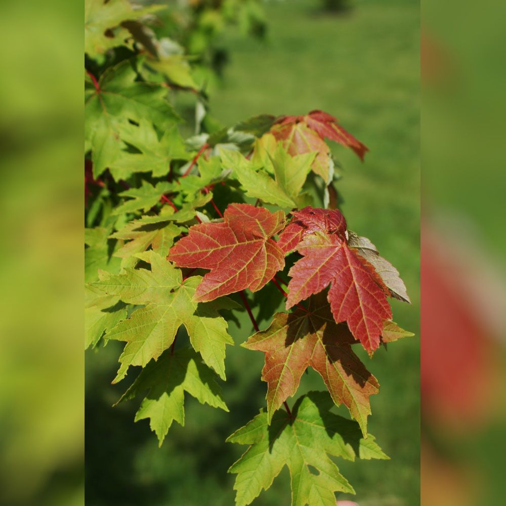
Red Maple
Before arriving at the next upcoming bench, you’ll follow along a woods filled with Red Maples. This maple has only three small lobes, compared to the five lobes Sugar Maple. Pioneers used the bark to extract ink. The Red Maple will turn all red in the fall, while the Sugar Maple will turn yellowish-red.
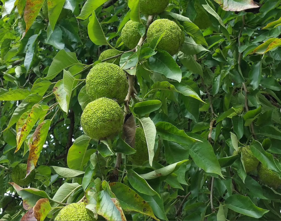
Osage Orange Tree
After the bench is the Osage Orange Tree, also known as the Hedge Apple Tree. The orange bark gives you a clue that it is in the Mulberry family. This tree came into our country and was used as a living fence row. Before 1873, barb wire did not exist and the only way farmers prevented cattle to stay in fields was making crude barricades of wood. The Osage Orange Tree came from the Middle East and when grown side by side, it produces a barrier of thorns stopping any animal from crossing. The wood is the second strongest wood found in Kentucky. The Honey Locust is the strongest. Native Americans made bows from the Osage Orange Tree as well as using it as a natural bug repellent. Paleontologists believe it was once food for the dinosaurs.
Passing the 303 mile marker and two concrete cylinders, you are now walking behind the Owensboro Country Club, established in 1956. Golf Fact: The momentum of a well hit drive just after impact is roughly equivalent to that of a bullet fired out of a typical 22-caliber rifle. The golf ball, which weighs 1.62 oz., can exceed 150-mph after impact. Just after impact, a person hit by a golf ball would experience similar contact forces as if being struck by a 22-caliber bullet fired from a rifle with a speed of 750-mph. Remember that the next time you hear the words, “FORE!”
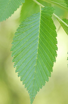
White Elm
On the other side of the country club fence is the American Elm, also called White Elm because of the white bark. All Elms have saw-toothed edges and the back of the leaf is more defined than the front. You can easily mistake the White Elm for a willow because of the hanging branches.
The Greenbelt, Horse Fork Trail takes a sharp left and you should see a concrete manhole on your left. From this point you will go through a canopy of trees before entering coming upon an open field. While walking to the open fields, realize you are walking in land that has been in the same family for over 200 years. This parcel of land, owned by George Mason since 1794, includes 60,000 acres of land that was left to his nine children. The impressive history of George Mason is displayed on the nearby monument. Note that one of Mason’s greatest accomplishments to this country is his authorship of the Virginia Declaration of Independence of Rights, of which Thomas Jefferson used as a model for the Declaration of Independence.
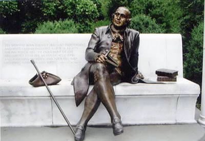
George Mason
In Washington, D.C. are statues that honor our founding fathers in the National Mall and Memorial Parks. In 2002, George Mason’s statue was added, becoming the only National Memorial of a person that has not served as President of the United States.
Thomas Mason Barron, the great-grandson of George Mason of Gunston Hall, settled alongside the Horse Fork Creek area around 1840. His house stood just on the Eastern side of Legion Park. An heir of Mr. Barron still lives on the land today.
A plaque about the history of this land and George Mason of Gunston Hall is to your left.
When the City of Owensboro negotiated the purchase of an easement along this land for the Greenbelt, the heirs never sold it, but instead leased it to the City of Owensboro for 100 years.
Interesting fact: Colonel John Daveiss in which our county is named, represented a lawsuit against George Mason in the United States Supreme Court in 1801. (Wilson vs Mason) The lawsuit disputed George Mason’s 60,000 acres of headright claims to his children in Daveiss County. The legendary Chief Justice John Marshall was on the bench and Colonel Daveiss won the decision. George Mason only had to part with 8,300 acres along Panther Creek. Also, Daveiss is not misspelled; our county was misspelled in the legislative act, which created the county on January, 14, 1815.
Walking along the open field, look down for animal tracks. Raccoons, ground hogs, deer, even creepy snakes can be seen. With the exception of one toe, the track of the raccoon and the woodchuck look the same. The raccoon has 5 toes on his front paw while the ground hog has only four. Why would you not find a ground hog in the winter months? They hibernate.
Look up! Each of those power lines carries 69,000 volts of electricity. Electricity brought to our homes by the largest municipal in the state, Owensboro Municipal Utilities (OMU). After being disgruntle by private institutions, local citizens got together in 1895 and voted 1,771 to 63 to start their own company. OMU turned on the juice at 4:25 p.m., 1900 and we have had power ever since.
OMU also provides water to our houses, using the same underground aquifer our citizens started using in 1900. The early settlers making whiskey and bourbon knew about the aquifer long before OMU took over. At one time Daviess County produced more whiskey than anyone in the United States, except Louisville. Many of the first settlers of Daviess County migrated here because of our water and the ability to make whiskey and bourbon.
Entering the last wooded area, let’s take a moment to review some of the things you have seen. Can you point out and name a tree or wildflower from this area that you learned while walking the Horse Fork section of the Greenbelt? Did you know that when you greet someone for the first time, you have a 70% chance of remembering their name if you say their name right after they introduce themselves. It also works for remembering plants.
Leaving the woods you are just meters away from the Wendell H Ford Expressway/US 60 Bypass. If it seems crowded with traffic, you are right. There are 27,000 cars that pass by this spot daily.
Take a right and you are at the end of the Horse Fork Trial and the beginning of the South Trail. In this section of the Greenbelt, you will discover German immigrants whose names are as prevalent today as they were in the 1800’s. You will also understand how family farms adjust in the ever growing expansion of Owensboro.
Crossing a small bridge with a tributary, you arrive at a parking lot. There you will find a Porta Potty and drinking fountain. To access this parking lot in your car, take Veach Road to Higdon Road.
Notice the sign about the Red Tail Hawk. This Hawk is a common yearlong residence of Daviess County which can easily be identified by a dark red tail. In the fall, all along the Greenbelt you can observe Red Tails following farm equipment. When farmers are thrashing wheat, the hawk will soar above the tractor waiting for a rabbit to run out. In the fall when wheat fields are turned over, they will soar above a tractor waiting for mice to run out. How does one distinguish a soaring Hawk from a soaring Vulture? …All Hawks soar with their wings straight across, while the Vulture soars with a distinctive “V” in his flight.
Notice the red brick building next to the parking lot. This is the Horse Fork Pump Station. In this building there are two, 20 inch pipes pumping up to 3 million gallons of water per day to the East treatment plant on Pleasant Valley Road. These pipes follow Horse Fork Creek. The City’s Regional Water Resource Agency pumps and treats up to 10,000,000 gallons of water a day.
The Greenbelt straightens with fence on both sides; you’ll see two mature trees coming up. The first one is the Catalpa Tree; which was identified on the Horse Fork Creek section. In the summer, leaves look similar to a tobacco leaf, but in the winter it is easily identify by its long hanging beans. In the fall, the Catalpa Tree has caterpillars eating its leaves. Great for fishing!
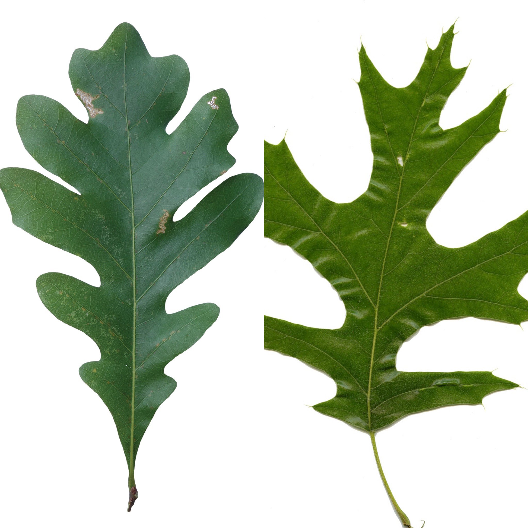
Red Oak & White Oak
The next massive tree is the Red Oak. We talked about Horned Galls found on the red oaks, but here’s how you identify all oaks. There are many sub species of oaks but all oaks go into two categories, they are either Red Oaks or White Oaks. How can you tell the difference? The Red Oak has pins on the edge of its leaves, the White Oak does not. The acorns from the White Oak are edible; the Red Oak has too much tanner and is very bitter.
A dormitory residence to your right is part of the Kentucky Recovery Network. Up to 100 adult men could be staying there. This program is totally a volunteer program and participants have the right to leave at any time. The men’s sole purpose while staying at this facility is to change, live a different life and find recovery. One of the neatest things you may observe is “Trudging” which means walking with a purpose. Two times a day the men trudge using the Greenbelt to take classes at a local church.
You are now crossing Veach Road. This road was named after a family living around 22nd Street back in the late 1800’s who woke up one morning to find the Milk Man was not only delivering milk, but a baby he had found on their front porch. The Veach family raised the child with no reservations and the county showed their appreciative by naming a road after them.
The trail continues on between the bypass and an open field. This open field was once a 20 acre, 7 ½ foot deep lake. The lake supplied the 350,000 tons of dirt it took to construct a four lane road and the exit and entrance ramps for Frederica Street.
You have now arrived at J.R Miller Boulevard. The trail heads south under the US 60 Bypass bridge. You’ve heard the saying, “As the Crow Flies.” Well, guess what, you have a chance to see how accurate your knowledge of distant is? The old O&R rail road went straight as an arrow until it got into Brown’s Valley. Look ahead at the tree line and guess the distance between you and that tree line. It is 1.1 miles.
Crossing Salem Drive, the building on the left is the Social Security Administration Building. As of July 2021, the unemployment rate for Daviess County was 4.4%, the State of Kentucky 4.7% and the entire United States, 5.4%. As long as records have been kept, Owensboro’s unemployment rate has always been lower than state and national levels.
The land behind the Social Security Administration Building, and most of the land you see, is known as the Butler’s Land. The Butlers bought the land in the early 50’s, but the land and its family history started in 1837, through the birth of Jacob Adelmann. Jacob was born in Germany, like most immigrants in this area. He arrived in America around 1860, first settling in Spencer County, Indiana but quickly crossing the Ohio River into Daviess County. He purchased 300 acres. Jacob and his German Prussia bride raised 7 boys and 1 girl. Jacob died in 1896, (Buried in Elmwood Cemetery) but his offspring prospered until the Great Depression in 1929. The estate was broken up and sold on the Daviess County Courthouse steps. Reathel Butler, a descendent of Jacob Adelmann, purchased 28 acres of land for $3,000 and the Butler house is still visible across the field.
JR Miller Boulevard follows the old railroad tracks of the Owensboro and Russellville Railroad (O&R). The City removed the tracks in 1984 and built the JR Miller Boulevard in 1989. The railroad began operating in 1871 opening the North/South spur through the middle of Daviess County. It was developed to move agriculture products. Farmers no longer had to haul their products by wagon to the Owensboro riverfront; they could load up at Riley Station (now Livia) and Lewis Station (now Utica)
The Owensboro Monitor newspaper wrote on February, 7 1871; “An excursion of about 600 ladies and gentlemen was made to Livermore this constituting the formal opening of the train for business. This excursion was a grand and joyful picnic, unmarred by accident.” Freight trains traveled to and from Central City which also included two daily passenger trains. Owensboro in the late 1800’s, up until the late 1950’s had so much train activity that 18 passenger trains a day went through Union Station on Frederica Street.
At the intersection, you will see the Ford dealership on Southtown Boulevard; Also note *JR Miller Boulevard becomes Martin Luther King Jr. Loop. The owner of the dealership once played baseball for both, the L.A. Dodgers and the Milwaukee Brewers. The dealership sits on 10 acres of land that was raised 5 feet. Adding lime to the dirt help to insure the soil would not settle. This was done because the surrounding farm land has been known to flood during the spring. The Brubakers are avid hunters and invite everyone to go to their showroom to view their hunting and fishing accomplishments. The collection includes tuna, barracuda, wahoo, elk, and deer, but you must stop in and see the 734 pound blue marlin.
JR Miller was built to take the 30,000 vehicle per day of traffic off Frederica Street (2002). Those numbers have changed dramatically. The first building on your right of Southtown Boulevard is Lowes. In one day, 16,000 people will walk through their doors, and in one year, 800,000 people. And that is just one of 100 businesses on Frederica Street.
In spring, this farmland floods and water can be seen covering the barren corn and soybean fields. This has been going on for hundreds of years. This happens because of the floodplain of Panther and Horse Fork Creeks are so close together. The water recedes by the middle of May and new crops are planted by the first of June. The State of Kentucky, although south of the Mason Dixon line, sometime has snowy winters. In February, the mean average of Owensboro is 38 degrees, but in March it raises to almost 50 degrees, plus that month gets an extra 2 inches of rain.
Interesting Fact: The annual mean temperature for May, June, July, August and September as observed at Louisville in 1841-1871 was 56 degrees. In Owensboro in 2014, it was 73 degrees. The average rainfall for the state of Kentucky from 1840 to 1870 was 60.3 inches. In Kentucky in 2014, it was 46.67 inches.
To the left, is a 300 foot cell phone tower. As a general rule cell phone companies do not own the towers. They lease them from a company like Crown Castle, the largest cell phone tower company in the south. AT&T, Verizon, Sprint, T-Mobile and U.S. Cellular all share the same towers. You can tell how many phone companies are sharing each tower by counting the transmitters.
The last intersection before Martin Luther King Jr. Loop curves and arrives at Hwy 431 is Theatre Way, the road got its name because a Malco 16 Screen Theater was once located here. Between 100 and 125 movies were shown per month and it had the seating capacity of 2000. The Malco Theater has been in Owensboro since 1943. The downtown theater production company Theatre Workshop of Owensboro (TWO) uses the old Malco Theater on Frederica Street to host productions. What movie has run the longest at Malco, running for over 3 months? Titanic
You are on the curve of Martin Luther King Jr. Loop and looking straight into the old railroad bed of the O&R railroad. Walking to the intersection of Hwy 431, you are actually crossing the path of an old buffalo trace which ran from Fort Hartford, in Ohio County, to the Owensboro Riverfront. Owensboro’s first settlers found Daviess County (Then called Yellow Banks) by following a Buffalo path which today would be geographically described as the route of Hwy 431 and Frederica Street. The buffalo trace was also used by Indians flourishing in this area. In the early history of Daviess County many people lost their lives because of the Indian/Buffalo conflict.
One historian wrote: “The sound of buffalo on the march could be heard a mile away, like the roll of distant thunder. Thousands of hoofs pounding the hard sod and dew claws rattling like the pounding and clattering of a freight train moving across a long wooden bridge. In the breeding season, one could hear the bellowing of the bulls, like a mighty roar all through the night, even when the herd was out of sight, maybe more than a mile away. Grazing, they scattered over this land in great herds, each composed of bands, twenty to sometimes two hundred in a bunch, with ten, twenty, or one hundred yards between bunches. The same herd could be in a range of twenty miles.”
You are at the intersection of Hwy 431. But back in 1860 it was known as Corduroy Road, leading to the business of Tom Petitt. Corduroy Road was a road built in swampy land, by laying logs side by side. It had to be replaced each year because logs would rot. Tom Petitt had a business making planks used in making barrels and kegs. It was called a Stave factory and did business for our local cooperage in downtown Owensboro, but also shipped his planks to Louisville, Jeffersonville and Pittsburg using the O&R railroad. When Hwy 431 was built, the hardest part was digging up the old logs which had collected through the years and in some areas 8 foot deep. Tom Petitt was also part owner and editor of the Owensboro Monitor, 1870. The community of Petitt is named after him. Petitt is one mile down the road where Panther Creek crosses Hwy 431.
Also, in this location, the Indiana Home Guard gathered before traveling Corduroy road to fight the Confederacy. The Battle of Panther Creek is the only Civil War battle recorded in Daviess County history. The historical marker documenting the battle can be found in front of Southern Oak Elementary on Hwy 431. In the battle, 36 Confederate soldiers were killed and 70 wounded. The Union Army lost 3 and 35 were wounded.
Crossing Hwy 431, the mega store Sam’s Club is to your right and the Burns farm to your left. The Burns family bought the land in the 1920’s and the house once stood on the other side of the aluminum grain bins. The second floor of the house was used as a hospital during the battle of Panther Creek. Just imagine waking up one day and seeing a hundred wounded and/or dead soldiers in your front yard!
Farming is always progressing and a good example is the simplicity of the grain bin. The 4 tin bins closest to the road, were built in the 50’s, each holding 5000 tons of grain. When the bins where filled, it was off to the market getting paid on that day’s market price. The farmer also made less money if their crop had too much moisture. Now, notice the aluminum bins at the Burns farm. Each one holding 30,000 tons and are air dried. Today’s farmers hold crops as long as they want and sell it when he thinks the market is good. Plus bins today have large blowers to keep moisture under control. (Moisture content accepted for best price in today’s market; Corn 15%, Soybeans 13%)
To the South past the Burns property, you will see a tree line…that is the boundary and outline of Panther Creek. On the other side of Panther Creek in the 1800’s was known as the Murray Precinct. Lewis Station (Utica) was in the Murray Precinct and in 1850, a hotel was built at Lewis Station to accommodate people coming to Dr. Hickman’s Miracle Springs. Dr. Hickman’s Miracle Springs was a sulfur pond which seemed to heal the sick and the lame. The hotel burned down in 1860, but a larger one was rebuilt in 1865. After the hotel closed its door around 1880, it was still a favorite place people gathered for picnics.
Looking west you can see Kamuf Park – Brescia University athletic fields. Baseball, Softball and Soccer are played there. Kamuf Park is located just south of Waymond Morris Park.
The Greenbelt curves and in the opposite field you’ll see the isolated patch of woods standing stoic among acres of farm land. Measuring land in acres, how many acres are in this one patch of woods? 6 acres.
The woods, lake and the land on the Greenbelt side is the Fulkerson Farm. Their tall gray barn is used for drying burley tobacco. Notice it is taller than most barns. In Daviess County, two types of tobacco are grown, burley and dark tobacco. Since burley tobacco is a foot taller than dark tobacco, it takes a taller barn to dry it out. Plus this barn is one of the few barns which has 4 tiers to hanging tobacco, most barns have only 3.
Kentucky tobacco growers lead the world in the production of burley tobacco, which is the type of tobacco typically used in cigarettes. Kentucky has held this ranking for the last 100 years. In the 120 counties making up Kentucky, Daviess County ranks number two in production.
The Fulkerson’s house, behind the barn was moved to that location in 1969. The old owners lost the house through eminent domain when the US 60 Bypass was being built. So instead of having a bulldozer tear the house down, the Fulkerson’s got their tractor and hauled it here.
The Fulkerson family received their land from Bob Green in 1951. Bob Green was the owner of Owensboro’s Executive Inn Hotel, once considered the largest hotel in Kentucky. Bob Green was a pioneer in digging coal and is considered the father of Kentucky surface mining. Starting his coal business in the community of Panther: just west of here, his mining operation was going strong, but soon hit a cross road when the Fulkerson’s farm in Panther stood in his way. Mr. Green found a quick solution; giving the Fulkersons this 106 acre farm. No taxes were paid since no money was exchanged.
Because of the swamp, this area has some of the richest and hardest soil found anywhere in Kentucky. The soil type in this area is known as Gumbo and Black Gumbo. Gumbo is rich, producing high yields of corn and soybean, and is also known to produce watermelons weighing 125 pounds. On the other hand, Black Gumbo is so hard a tractor’s disk cannot break it up.
Arriving at South Town Boulevard you should see the bus garage of the Daviess County school system. If you don’t see yellow, you’re probably lost.
Through drainage and construction the landscape has changed dramatically in Daviess County, but there are still signs in the existing landscape, giving clues into the past. Notice the higher bank on the other side of Southtown Boulevard. It is just a small hill, but one of the few remaining remnants showing that the swamp ended here. This is a rift (bank) caused by silt build up. Another clue that this was higher ground is the small family graveyard not recorded in Daviess County history. The head stones are gone. Through years of erosion it has been reduced to nothing more than a strip of high Johnson grass. The strip is always visible and farmers never plow it out of respect for the dead.
Most of this land in Southern Daviess County was settled by German descendants. They were known as Ditch Diggers, because they could drain any field of water and were relentless in accomplishing their goals. Buying land for as low as 1 dollar an acre, they faced the constant smell of stagnant water, disease and mosquitoes. Yet, between 1870 to the early 1900 they kept coming from Dubois and Spencer County, Indiana, traveling by wagon over the Ohio River. Many families struggled, not knowing the language and the Catholic Church became their only support.
Apollo High School is at the intersection of Southtown Boulavard and Gemini Drive. The school opened in 1969 as a junior high school and was named after the Apollo Space Program. It converted into a high school in 1972. Famous alumni include, Rex Chapman (former NBA player), Brad Wilkerson (former Major League Baseball Player), and Michael Waltrip (former NASCAR driver). This high school began offering a bike riding class because of the Greenbelt.
Crossing Todd Bridge Road, the Greenbelt travels along land once owned by the Massie family. The Massie family left Virginia in 1820, before arriving in Owensboro around 1850. The father made his fortune in tobacco, but his three children continued the family’s success by accumulating huge amounts of land. At one time, you could walk from the Ohio River to Panther Creek and never step off Massie owned land. The Health Park, Wesleyan Park Plaza, Kentucky Wesleyan College, Town Square Mall, Rosehill Cemetery and Elmwood cemetery were once owned by the Massie family. January 3, 2000, the worse tornado in the history of Owensboro destroyed the Presidents house at Kentucky Wesleyan College. The house was the former home of Bob Massie, built in 1907. The President’s house and many acres of Kentucky Wesleyan College were also donated by the Massie Family.
Looking beyond Massie land, you should see the stadium lights of Waymond Morris Park. Waymond Morris was a teacher, football coach and a former Mayor of Owensboro. He played football for the University of Kentucky (1955-58), so it was only appropriate that the City dedicated this state of the art football complex in his name. It has four fields and a 1.5 mile walking path encompassing a lake. During football season games are played almost daily and the regional and state tournaments are held here.
The house, barn, stables and pump house on the hill are remaining structures of a very busy German family named Blandford. The Blandford’s still own and farm the land today, but the days of Aunt Annie raising 13 children, slaughtering pigs, making blood sausage, pumping water and milking cows are over. The Blandford family made extra income selling milk. Most German families in the early 1900’s had a dairy farm, selling milk in 5 gallon containers to the Velvet Milk Company on 3rd Street. Children always tried accompanying their parents to the milk company to receiving free ice cream sandwiches. The Blandfords bought the 76 acres of land from another German family named Goetz (1880) and the two families are as close today as they were over 100 years ago. On the stable, engraved on an 8X8 wooded post is a date the barn was built. Feb. 24, 1929. The old barn was destroyed by lighting.
In the background, behind the Blandford property stands tall grain bins. This is the family owned business of Miles Farm Supply. They do business in Russia, Romania, and most of the southern states in America. They even own a 60,000 acre farm in Bolivia. How did this family start such a successful enterprise?
Around 1937, Billy Miles fell in love with Virginia Wells, but there was a problem, Billy’s mother didn’t agree with them dating because Virginia was two years older. The couple snuck off one spring, without momma knowing and visited the newly established National Park, Mammoth Cave. Driving through Butler County, in the City of Morgantown, they noticed a man having car problems. Since they weren’t in a hurry, they stopped. Billy was a farm boy and knew how to fix about everything and quickly fixed the car. But while fixing the car, Billy and Virginia made conversation telling how they wanted to get married. The man told them not to worry and just follow him to the Butler County Courthouse. Arriving at the courthouse, the man confesses that he was the County Clerk of Butler County as he unlocks the door and goes inside. Coming out, he gave them a certified marriage licenses. Billy and Virginia got married in Morgantown 6 months later. Virginia got a job at Ken-Rad, making 15 cents an hour. Billy made money raising tobacco. They were married 70 years before Virginia went to the Lord. Two years after her death Billy, at the ripe old age of 93, got back into his car and drove to the court house of Butler County. There he found the copy of their 72 year old marriage licenses. Billy always knew “In business it’s about luck, hard work and being in the right place at the right time. But my greatest success was marring Virginia. I’d give up everything if I could have her back with me.” (William “Billy” Miles)
At the intersection of Southtown Boulevard and Carter Road, is Twin Lakes, on the opposite side Tamarack Park. In this area of 100 acres, all the houses were built by the Jagoe family. For over a century, this family has been involved in some form of building. The first Jagoe arrived from Ireland and built saddle horns. Then moving to Muhlenberg County, they became loggers floating timber down the Green and Ohio Rivers to a lumber yard in Evansville. Today, the family is represented by two brothers, Bill and Scott Jagoe. So far Jagoe Homes has built more than 9,000 houses throughout Kentucky and Indiana. The Jagoe Company has won many energy star awards for their ability to build energy efficient homes.
The Greenbelt crosses Southtown Boulevard and travels north along Carter Road. Carter road gets its name from an early family, whose land sat next to D.M Griffith land. (Griffith Avenue) D.M Griffith, a real estate mogul, married the Granddaughter of Isaac Shelby, the first governor of Kentucky.
Notice the large brick house on the other side of Carter. This house was built by George Fischer, another German Immigrant, known for building the best houses and barns in this area. If you see any barn in the area having three, 5-point stars on the front of the barn, it was built by George Fischer. George Fischer was paid $5.00 a day to build this house.
George Fischer built this house for Martin Wilson. Martin Wilson bought 465 acres from Kate Cowan in 1884, paying $670.00. Martin was a true entrepreneur, farming, building, selling and buying land until he went bankrupt in 1921. The O’Bryan family (Owensboro Grain) bought the land at public auction after the bankruptcy. Martin Wilson was instrumental in helping build Big Ditch, which was led by the German family, Scherm. The ditch was 10 miles long and took 40 years to build. Using only shovels, picks, and axes it stretched from Kentucky Wesleyan College, down Carter Road, until it drained into Panther Creek.
The Greenbelt passes a white fence. On the other side of the fence is part of the Big Ditch project.
When you cross Latrobe Avenue, you are heading into the area of Atlantis. These two businesses take up three acres. One is a fitness club; the other is a private swim club.
Atlantis Fitness and Atlantis Swim Club, plus the entire neighborhood of Tamarack Park were once owned by the Scherm family. The Scherm family built the famous Big Ditch. They did not live in Daviess County. Instead they allowed another German family, the Kuegels, to farm the land. The Kuegels were paid a salary and lived in a house the Scherm family provided. This was known as sharecropping. They worked this land almost 20 years. After the Great Depression, the family took a chance and bought 80 acres in 1946. Today, the Kuegel family farms 4,000 acres and raises over 500 heads of cattle.
After the depression, many families found opportunities to buy cheap land, but with a huge risk. Bankrupted farms were found everywhere in Daviess County and borrowing money was like playing Russian roulette. The entire United States became scared, losing faith in our banking system. Everyone knew someone who had lost everything. Another German family, Schrecker, having 7 children, lost their entire farm because they could not pay the $600.00 property tax bill.
To further the family’s survival after the Great Depression, Bill Kuegel became a tenant farmer for the giant land owners, Massie. Tenant farmers do not live on, or own land they farm, but share a percentage of the crop when it’s harvested. The Kuegel family still tenant farms for the Massie Family today.
Because so many Germans lived in Daviess County in 1863, an American German School opened in Owensboro teaching English to the German youth. It closed in 1871, the same year Owensboro City School District opened. These are only a few names of the early German immigrates still living in Daviess County today….. Alvey, Bittel, Brian, Blandford, Collignon, Ebelhar, Fischer, Fogle, Fletcher, Gipe, Goetz, Hager, Hayden, Hoffman, Hurm, Keller, Krampe, Kuegel, Lane, Lindemann, Mott, Morhart, Norris, VanMeter, Schmidt (Changed name to Smith) Schrecker, Wilhoite, Wink, and Zoglmann.
If you were walking this part of the Greenbelt on January 3rd, 2000, chances are you would have been blown away. At 4:00 p.m., the path of an F3 Tornado ripped through this area causing millions of dollars in damage, but no lives were lost. It completely destroyed 100’s of homes. Although Apollo High School, Burns Middle School and Kentucky Wesleyan suffered severe damage, the students had already left school property. Surprisingly, most people in Owensboro were ready for such a disaster, having stored supplies because of the Y2K scare. All computers in the world were predicted to shut down on December 31, 1999. When arriving at the stop light, looks down Tamarack Road. Shade trees lined the road before January 3, 2000.
10,000 cars travel Tamarack Road daily.
At the corner of Carter and Tamarack Road, stop at the gas station for a bathroom break and refreshments. There’s a button to press causing the stop light on Carter Road to change.
Crossing Carter Road, you are now in the Mid-America Airpark. The area is 450 acres of industry which opened in August, 1995. The land was purchased from the O’Bryan family. Before the Greenbelt bends right, look at the offices of U.S. Bank, the second largest employer in Owensboro. U.S. Bank in 2014 had 360.7 billion dollars in assets. With the exception of the country of South Africa, U. S. Bank beats every Gross Domestic Product (GDP) on the Africa Continent. GDP is the market value of all final goods and services from a nation in a given year.
You are 1.6 miles from Russell Shifley Park.
The Greenbelt takes a sharp right and heading north towards “L” substation. The substation was built entirely by OMU employees, with wires bringing in 69,000 volts of electricity. This substation reduces the voltage to 13,800 before sending it out to business and homes. Transformers, found all around Owensboro, further reduce voltage so we can run 110 and 220 appliances. “L” means this substation is the 12th substation built. Instead of using numbers, OMU uses the alphabet.
The 125,000 sq. ft. office and warehouse building to your left is CRS OneSource. It is the combination of Clark Restaurant Service, Inc. and CRS Frozen Foods, Inc. CRS OneSource purchases food products and supplies from approximately 300 manufactures. They are then sold and distributed primarily to restaurants, schools, hospitals and nursing homes. Marvin Clark started his business in 1948, having only a dream and one small truck to supply local restaurants with wholesale food products. The company was located for many years at East 10th Street and Leitchfield Road, near Chautauqua Park. Today, Marvin’s dream has grown into doing business with over 2,500 customers in a 150 mile radius. CRS is a family owned company still being operated by the Clark and Frey families.
The Greenbelt information board visually lays out the Greenbelt and the City of Owensboro. You will also see a picnic table and trash can. Please don’t litter, respecting the environment is what the Greenbelt is about.
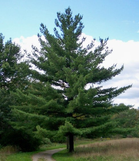
White Pine
White Pines were planted leading to Bullfrog Boulevard. You can tell how old white pines are by counting branch sections. A new section develops each year. White Pine needles are enriched with vitamin C.
Cross Bullfrog Boulevard and head west. Bullfrog Boulevard was once the road leading to Bullfrog fuel and maintenance, a full service fixed based operation for airplanes.
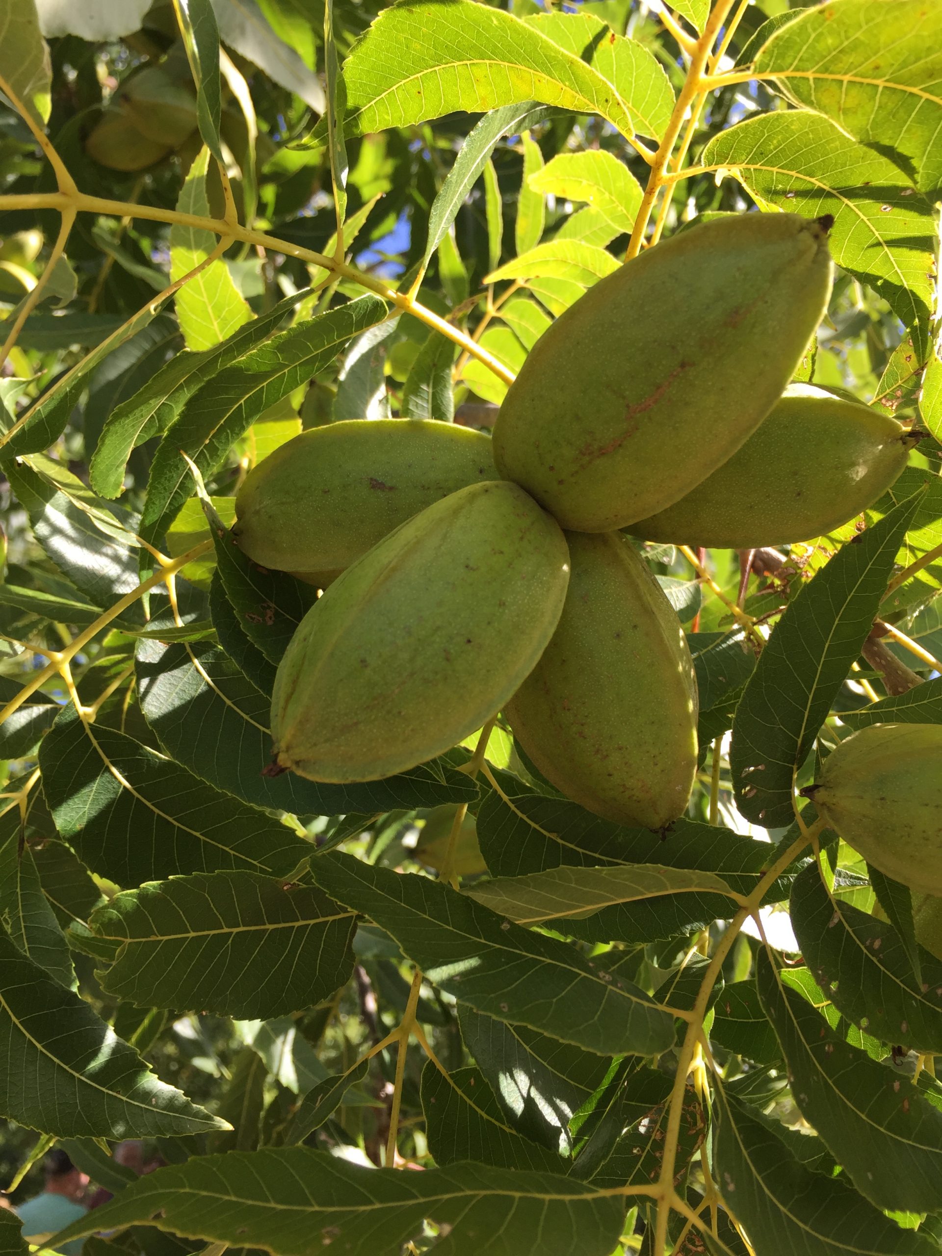
Northern Pecan
Looking out into the open fields, you will see two lonely trees standing by themselves. They are Northern Pecans. Owensboro is the northern most spot to produce pecans. If you go into Southern Indiana, you will find the tree, but not the nut. The pecan was spread throughout the south by the Algonquin Indians. Thomas Jefferson also helped giving out pecan each place he visited.
Approaching the intersection of Bullfrog and Airpark, you should see hangars in the Owensboro Airport. In 1965, you could walk up to a pilot and fly 15 minutes for $5.00. There was no security at airports until December 1972.
The Greenbelt takes a right angle and heads north; the company Toyotetsu Mid America (TTMA) is on your left. Opening in 2002, this company makes stamped and welded metal automotive parts. Main products include radiator supports, center body pillars, cross members, crush boxes, lower arms and parking brake levers for Toyota. They have approximately 540 employees.
Notice an old blacktop roadway going nowhere through the field. This was the road leading to a farm house. On the 1949 aerial map of this area, you would see only the house and pecan trees. Everything else was farmland.
UniFirst is on your right. This company started supplying uniforms, work wear and related products for businesses in 1936. They also offer floor care and restroom services products. The company is known for their eco-friendly, environmentally–conscious products, doing everything they can in reducing the carbon footprint. They have approximately 341 employees.
Arriving at the intersection of Airport and UniFirst, the “Rules of the Greenbelt” sign is found between two transformers. No Vehicles, No Motorbikes, No A.T.V.s, No Horses. …By the way, what horse from Owensboro won the Kentucky Derby in 1985? …..Spend a Buck.
The Greenbelt bends around a cul-de-sac, heading to an eight foot fence which encompasses our airport.
The empty building on the other side of the cul-de-sac is a result of bad circumstances and logistics. This company made parts for the Toyota Tundra. They also had another plant in Illinois. When Toyota opened its second Tundra plant in Texas, doubling its production, the price of gas rose to over four dollars a gallon. No one wanted a full size V8 Tundra truck. Within 6 months this business went from 60 million a year to bankruptcy.
At the fence the Greenbelt, turns right and heads northeast. It is ¼ mile walk to the US 60 Bypass. There were around 3,000 people working in MidAmerica Airpark in 2014. It is hard to imagine that scarcely 200 people lived in the entire county in 1833 without a single church or organization. The Owensboro Census has steadily grown each decade.
Censes of 1840…6,327 Whites, 1,960 Slaves
Censes of 1850…9,419 Whites, 2,889 Slaves
Censes of 1860…11,958 Whites, 3,515 Slaves
Census of 1870…17,111 Whites, 3,600 Freed Slaves. After the emancipation of slaves, manual labor went sky high. African Americans demanded $200 to $250 a year to work on farms.
Census of 1880…22,008 Whites, 4,528 Freed Slaves. Immigrants from Germany, Scotland and Ireland were now migrating into Daviess County becoming cheap labor.
In 1850 there were 1,631 dwelling in Daviess County. Today, there are over 43,000 housing units in greater Owensboro area.
In this open area, you may see a lot of walkers, runners and bike riders. Give a friendly Kentucky smile, wave and say howdy. If you’re from the north, here is a question, “How do you pronounce the capital of Kentucky?” Louis-ville or Lou-ville? Frankfort is the capital of Kentucky.
God is not making any more land, but Daviess County farmers have figured out how to grow more crops. In 1872, the farmer in Daviess County produced 900 pounds of tobacco per acre, 40 bushel of corn per acre and 20 bushels of wheat per acre. In 2013, the farmer in Daviess County produced 2,100 pounds of tobacco per acre, 200 bushel of corn per acre and 130 bushel of wheat per acre.
The Greenbelt approaches the US 60 Bypass, turn left and travel along the 887 acres of the Owensboro-Daviess County Airport. Built in 1949-50, the runways are 8000 feet. Only Louisville and the Greater Cincinnati Area Airport have longer runways. 60,000 passengers pass through the 261 seat terminal yearly, and the Kentucky National Guard is located on the property. It is not uncommon to see C130 transport planes doing touch downs.
The worse disaster in America History was the 1811 New Madrid Fault earthquake. Within three months, four earthquakes, registering up to an 8.1 on the Richter scale, completely destroyed the area and caused the Mississippi and Ohio River to flow backwards. The runways at this Owensboro-Daviess County Airport were built to survive such a disaster and is the only Readiness Center of the Tri-State if such a disaster should occur again. It cost 26 million dollars to build the runways.
Daviess County is home of Wendell Ford, the 53rd Governor of Kentucky and a U.S. Senator for 25 years. The US 60 Bypass is honor of him (Wendell H Ford Expressway) as well as the Owensboro Daviess County Airport. Wendell Ford became the chairman of the U.S. Aviation Committee, starting the first safety guidelines for America’s airline industry. Through the Wendell Ford Aviation Investment and Reform Act, airlines must follow guidelines to make sure we are safe, reduce noise, better inform customers and protect employees who discover safety concerns.
There are two major runways at the Owensboro-Daviess County Regional Airport, East-West and North-South. You will cross beneath the flight path of the North-South. In this geographic area, most winds blow East-West and planes land and takeoff facing the wind. The first commercial flight at the airport was March, 1951 through Eastern Airline.
At the bend, you should see a bench and trash can. Sit down and count cars. If you set all day, you would count 20,000 automobiles with 12.7% being semi-trailer trucks. If you sat on that bench for 20 years, you would count 18,453,000 automobiles.
“The beginning of Burgoo”
You are approaching the intersection of Bittel Road. The Bittel name is synonymous with the Catholic faith and the beginning of our regional soup, Burgoo. The Bittel genealogy can be traced from George Bittel from Bavaria Germany (1672) to the arrival of his great-great-great grandson George in Rome Kentucky in 1888. Like most German Catholics in the area, the Bittel family attended St. Martin Catholic Church in nearby Rome. The priest at St. Martin during 1888 was Father Louis Herberth, also from Bavaria Germany. These two men started making Burgoo, a Southern version of Brunswick Stew. The first picnic was recorded in 1934 on the grounds of St Martin, but before 1934, the picnic occurred for decades at the Reisz farm ½ mile from St. Martin. Today at the annual Bar-B-Q Festival, over 1,500 gallons of Burgoo is made by every Catholic Parish in Daviess County determining who can make the best. Over 125 years later, the Bittel family is represented in every Catholic Church in Daviess County. But at St. Martin, the Bittels are still represented by their priest, Father Patrick Bittel!
Cross Bittel Road and walk under the bridge, you are heading toward The Father’s House Church, formerly Good Shepard Church. Look across the street from The Father’s House and you will see the homestead of the Bittel family. The house was built in 1883 and is listed as a Kentucky Landmark. It was built by the Reverend Charles Gates, a traveling preacher, preaching the second Sunday of every month at Cumberland Presbyterian Church. The Bittel family moved there in 1909.
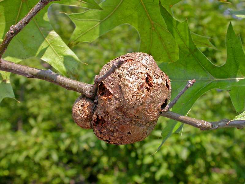
Horned Gall
Pin Oak
The trail goes behind the property of The Father’s House. Trees outline the back of the church property, with a row of Pin Oaks. On Pin Oaks, you will see Horned Galls. Horned Galls attach themselves to Red Oaks and the Pin Oak is in the Red Oak family. Inside of each of the gnarly looking wooden balled shaped galls is one tiny wasp. It will live in the gall for about two years before breaking out and laying eggs. When the buds break in the spring and leaves begin to expand, this small wasp starts laying eggs in expanding plant tissue. 90% of the time, the tree is never in jeopardy. This is a natural phenomenal that happens all the time. The common sweat bee is only produced by making and living in the galls of the Goldenrod plant. Also notice the Northern Pecan back at the curve of the Greenbelt.
You are nearing the area of Russel Shifley Park. This park is dedicated to Russel Shifley (1898-1987) in honor of 56 years of service in the City of Owensboro. He started working for the City in 1917 and became Superintendent of Sewer and Streets. During his tenure, he constructed many miles of sewers and streets in Owensboro. This is one of the few parks not named after a former mayor, although Russel Shifley was a City Commissioner when the park was established in 1975.
Inside Shifley Park is the satellite sports facility of Owensboro High School (OHS). OHS has one of the most respected sports program in all of Kentucky, winning many state championships. Its alumni have gone on to become college stars and professional athletes. Shifley Park is the home of the OHS soccer field, baseball field and softball field. At one time, the Owensboro Public Schools leased Shifley Park from the City of Owensboro. In 2014, a land swap was made. The City took ownership of the land immediately west of Shifley Park and the OHS soccer field and built the Owensboro Tennis Complex which is home to 9 outdoor courts and Centre Court an indoor tennis facility. Owensboro Public Schools now owns the park. The Greenbelt turns left and crosses a bridge. Take a right to enter Shifley Park.
If you go straight on the Greenbelt, you are headed towards Parrish Avenue. This is the beginning of the West Owensboro Trail. This area’s history has lead Owensboro into what it is today. Walking up to Parrish Avenue, you’re elevating from 400 feet to 415 feet above sea level. The elevation range in Kentucky is more than 3,500 feet. Daviess County in Western KY is considered one of the lowest. In Harlan County in Eastern KY, Black Mountain raises 4,139 feet above sea level.
The Greenbelt passes apartments to the left and the back of a strip mall and Kroger to your right. This area was once a drive in theater called Starlight Drive-In. Initially owned by Andy Anderson of Hartford, KY and later by Malco Theatres, the Starlight operated for forty years. Opening after World War II in 1949, it closed in 1988 when the screen was burned by vandals. The last movie shown was Bull Durham. Andy Anderson bought the land from Walter Osborne, who inherited the land from his father Simeon Osborne. In 1875, Simeon Osborne owned land throughout Daviess County including the land where Elmer Smith “OMU” power station sits today. The Osborne family still owns and operates the Big Dipper on West Parrish Avenue.

Silver Maple front and back
The area along the Greenbelt across from the strip mall has plenty of mature Silver Maples, also called Water Maples. You will notice the trees having a low fork in the trunk and exposed roots. This occurs because they grow so fast and are known to have soft wood. If there is wind damage after a storm, 9 out of 10 times the damage is causes because a Silver Maple splitting apart.
You will cross a road leading to the strip mall and then traveling another 100 feet, before arriving at Parrish Avenue, also known as Hwy 81. Take a right. This road was once called McFarland Avenue but was renamed for a prominent family of three brothers. The Parrish brothers were bankers, owners of a land company, and instrumental in the development of Chautauqua Park. But with the unforeseen stock market crash in 1908, scandal hit Owensboro and the three brothers. They were all indicted on land fraud charges.
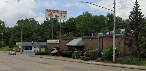
Walking to the stop light, you are one block from the famous Moonlite Bar-B-Q Inn. In one year, an unbelievable 300,000 people will travel through their doors. The history of Bar-B-Q is huge in Owensboro and we have the picnics and festivals to prove it, but with Moonlite in our community, there is no one better to publicizes it. United State Presidents and famous celebrities have eaten there. Articles have appeared in Southern Living, Money Magazine, Atlanta Journal, Los Angeles Times and Kentucky Monthly. (Many times in Kentucky Monthly) This famous restaurant started with a true American dream. Huge “Pappy” Bosley worked for a local distillery and was laid off. Having five children, he and his wife, Catherine, moved in with her family, and bought this Bar-B-Q restaurant. In 1963, it was a 30 seat establishment. Today it is a 350 seat establishment, known throughout the United States.
Interesting facts: The Kentucky Geological survey studies show Parrish Avenue for 20,000 years was once the path of the Green River. The Green River turned east from the small Daviess County community of Curdsville, traveling into Owensboro along Parrish Avenue. It turned north around the Blue Water Tower, flowing out into the Ohio River by the Downtown Convention Center. Curdsville was named after a steamboat captain on the Green River (H.T. Curd) who paid an early settler a barrel of whiskey to name the town after him. Also, guess how many gallons of water are in the Blue water tower. 1 million gallons.
(Push the Pedestrian Crossing button to stop traffic light for your crossing. Be careful, the light will automatically turn green after 30 seconds.)
From the stoplight, the Greenbelt runs parallel to Parrish Avenue. It will dip and rise as you pass two rock retaining walls. The land to your right was once owned by the Bosley family. This piece of land runs to the cell phone tower at the entrance of Jack C. Fisher Park.
Warbler
Look at the sign, Eight Backyard Birds. Daviess County is blessed to have so many birds. Starting in spring, birds migrate from Mexico, Central and South America into the area. With every bird, our trees and underbrush are transformed into a bird watchers paradise. In the winter months when insects die, birds such as the 38 species of Warblers migrate South. Most of the birds on the Backyard bird sign hang around during the winter, surviving on dead insects and seeds.
Black Locust
As the white fence descends, notice the line of Black Locust. In the summer it is identifiable by a compound leaf. In the winter it is identified by a hanging light colored seed pod. The tree isn’t pretty and doesn’t stick out like the impressive oak, but it has been a major contributor to the development of our county. The Black Locust will not rot for 50 years and because it will not rot, underground coal mines used the wood in supporting coal rooms. The first operational coal mine in America was in 1820 in Muhlenberg County, KY. In Daviess County, Robert Triplett also began digging coal in 1820. (You’ll read more about Robert Triplet on down the path)
The bridge is a Pony Truss Bridge. Meaning it allows traffic through the truss, but the top of the bridge is not joined together with cross braces. This bridge came from Logan County, in the small community of Gordonville. It was built in Gordonville in 1930. The bridge was touted as being able to support horses and Model T farm trucks.
The fence row on the bypass side is full of vegetation. Winter Honeysuckle, Trumpet Creeper and Honeysuckle were never planted, but grew here as a result of birds releasing their bowels. This sounds funny, but ever tree, shrub, grass and wildflower were planted because of birds. Even fish found in the remote places of the world, are also placed there by birds. Birds eat, digest and distribute seeds on fence rows and in ponds. They wade in river and creek banks unknowingly collecting fish eggs, then flying to another pond and disperse them. Nature is amazing!
Nature has also been the reason Owensboro has grown. Between 1837 and 1876, Owensboro had 23 tobacco warehouses, storing and sending tobacco throughout the United States and Europe. The seal of the City of Owensboro was adopted April 18, 1886 and tobacco was so important it included a tobacco leaf. The corn raised became whiskey. Between 1868 and 1880, Owensboro had 18 distilleries distributing product throughout the United States by train and steamboats.
At the cell tower, take notice of the different antennas branching from the 300 foot cell tower. Each branch is a phone company renting space from the cell tower company. Phone companies rent cell towers with many companies using the same tower.
 Entering Jack C. Fisher Park, you are heading northeast on the busiest part of the West Owensboro Trail. On any given day, you may observe softball players, roller bladders, bicyclist, joggers and/or fishermen. This park has four softball diamonds and this is where the Kentucky State Softball Championship is held. There is a .07 mile walking path encompassing the park, with two stocked public fishing lakes. Rainbow Trout is one of the fish stocked. Many walker, bikers and runners will use Jack C. Fisher Park as their starting point. It is 1.3 miles to Joe Ford Nature Park and Center and .5 miles to Shifley Park.
The softball complex at Jack C. Fisher Park underwent major renovations from August 2019 – December 2021. Synthetic infields were added along with, an outfield irrigation system, batting cages, front parking lot expansion, installed a playground, replaced the service building, added parking in the front and back lots, and entrance.
The land bordering Fisher Park, on the other side of the Greenbelt is the largest piece of privately owned land inside the 60 bypass. This 135 acres is owned by the Hayden family. The Haydens bought the land from the Bosely family. The Haydens are another German descendant whose children have become well known. Tommy, Nicky and Roger Lee Hayden are famous motorcycle racers. Nicky Hayden nicknamed, The Kentucky Kid, races on the world cup circuit and won the MotoGP World Championship in 2006. Nicky Hayden was tragically killed while riding his bicycle in Italy. Hayden was posthumously inducted into the AMA Motorcycle Hall of Fame in 2018.
Johnny Depp, the actor was also born here and his father was once an engineer for the City of Owensboro. The Haydens bought the land from the Bosely family.
From this point on until you get to the other side of Jack C. Fisher Park, enjoy the walk. This is a beautiful park with so much activity. See you on the other side!
Crossing 5th Street Road, there is a gas regulation station. Like electricity, the volume of gas has to be reduced to operate inside our homes. This station takes 300 Pounds per Square Inch (PSI) and reduces it to 55 PSI.
Three barns can be seen in the 114 acre Whittinghill farm. Whitttinghill farm was once part of the dynasty of the Massie family, a family of three brothers owning land from the Ohio River to Panther Creek.
The Greenbelt follows OMU power lines, each carrying 69, 000 volts of electricity… and down a little farther a concrete mile marker (#105) telling you it’s 1 mile to the parking lot at GRADD.
The Greenbelt develops a slight bow as it follows the old West 5th Street Road, but corrects itself before taking a right. Please don’t litter and if you see litter, put it in the trash cans found all along the Greenbelt. In this area many trees are labeled by the Joe Ford Nature Center. On this fence row, there are Hackberry, Cherry and Mulberry Trees.
Pokeweed
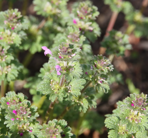
European Henbit
Notice old trees having barb wire growing into their bark as well as wildflowers growing abundantly. The common European Henbit (purple and small) was used by herbalist to stop bleeding. The Poke plant is still used in salads during spring time, but you have to boil the leaves twice before getting out the toxins.
The trail snakes its way to the bridge of Devin’s ditch. Devin’s ditch goes behind and travels under the exit of Audubon Parkway. Audubon Parkway comes out of Henderson County and exits onto the Wendell Ford Expressway, also known as 60 bypass. Stay on the trail, quicksand was found around Devin’s ditch by the project engineers of the Greenbelt.
To the right, a rock retaining wall and one of the barns on Whittinghill Farm can be seen. Cottonwoods and Sycamore Trees line the ditch to your left. These trees survive in water and are found throughout this area. You should also see the mile marker 103. In the barn area, check out bird activity. Barn Owls have been seen coming out of the barn.
The trail straightens out with a row of planted trees to your right. Notice the White Oak does not have pins on the edge of its leaves and that is the difference in identifying a White Oak from a Red Oak. When identifying oaks in the winter notice the lower limbs stick straight out with leaves staying on until early spring.
When Daviess County was officially established on January 14, 1815, this area of Daviess County was known as Lower Town Precinct. In the Lower Town Precinct was Bon Harbor Hills and Bon Harbor Hills was the first location of a coal mine in Daviess County. A man named Robert Triplett, which Owensboro’s Triplet Street is named after, dug the first coal mine (1820) and by today’s standards, would have been considered a billionaire. He sent his coal by train to the river to steamboats. It is in the record books that Robert Triplet had the first railroad this side of the Appalachian Mountains. He used metal tracks, coal cars and gravity in getting to the river. The cars were pulled back with mules. He not only supplied coal to steamboats, but made steamboats as well. He also had a textile factory, and a couple of distilleries. At one time, he had the largest textile factory in the south, employing over 300 people, many who came in from Europe.
The Audubon highway merges into the U S 60 Bypass at the tree line. As the trail weaves itself around a small ditch, you will find a resting bench.
The trail straightens back out and you are almost at Joe Fords Nature Center. The field to your right is 23 acres and was once owned by the Massie Family. Many Indian relics have been found on this land. Indians roamed this area for 12,000 years, before European settlers forced the last Shawnee out of the area in the early 1800’s. The last man killed by an Indian was Thomas Down, a Baptist preacher around 1800. This land is now farmed by a tenant farmer. A tenant farmer rents the land and gets a percent of the profit. Most farmers in the area use a 2/3-1/3 way of determining profit. The person owning the land gets 1/3 of the profit, the person farming and harvesting the crops get 2/3 of the profit.
The Greenbelt takes a right and is now on the Old Lee Rudy Road, boarding the property of Joe Ford Nature Center. The old Lee Rudy Road, for decades was a passage way between Rudy Coal Company and Highway 60. Highway 60 did not exist until 1916 and was not paved until 1931. This road was the major road leading to Bon Harbor Hills.
There are many trees to identified giving you another chance to review what you have learned.
Reminiscing, Joe Rudy, son of Lee Rudy, tells of being born in 1924 and as far back as he can remember, his father mined coal. The miners used this old road to go to and from the mine, selling coal in downtown Owensboro. Ponies hauled wagons full of coal day and night. Some ponies were blind, after being deprived of sunlight for so long. On Highway 60, two miles west of here, you can visit Rudy Mine Trails at Ben Hawes Park. There, the working mine of George Rudy is located. George was the brother of Lee. It has buildings still intact with pictures of the old Rudy Mines that operated from 1895 to 1950. Ben Hawes park is 553 acres and includes and 18 hole golf course, 9 hole Par 3 golf course, Foot Golf, 3 picnic shelters, a playground as well as bike and walking trails.
You are arriving at the Joe Ford Nature Center. This was an amazing man who dedicated his life in educating the public on nature. Besides having a nature trail encompassing the grounds of the Center, the Center itself had artifacts and articles not found anywhere else. Joe was not only the naturalist in Daviess County for decades, but found the artifacts now on display in the Center. The Center, besides being a small museum, has books Joe wrote on the history of Daviess County. The Center is also used as an outside classroom by many local schools and clubs. The building was dedicated in 1986. Please stop in and see how one person can make a difference in so many lives. Joe Ford was a cousin of Wendell Ford, the U.S. Senator and Governor of Kentucky.
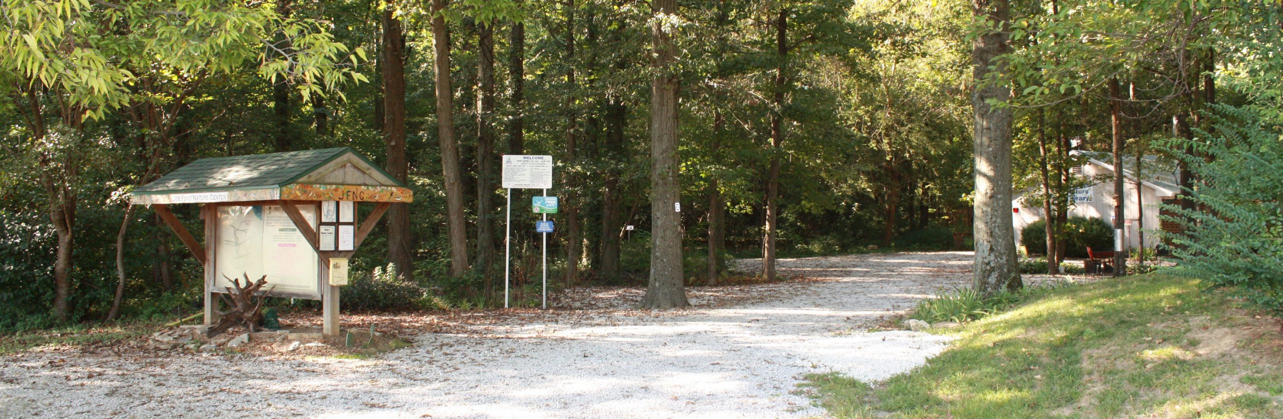
Through decades of being the official Naturalist of Daviess County, Joe planted a kaleidoscope of wildflowers on the grounds of Joe Ford Nature Park. During the spring, walk through and learn their names. More you learn about nature, the more you’ll keep coming back.
Arriving at the parking lot of Joe Ford Nature Center, we sure hope you enjoyed your adventure on the Greenbelt. Please come back again and again and again.